Subject: South Central United States
Period: 1863 (circa)
Publication:
Color: Printed Color
Size:
25.2 x 23.5 inches
64 x 59.7 cm
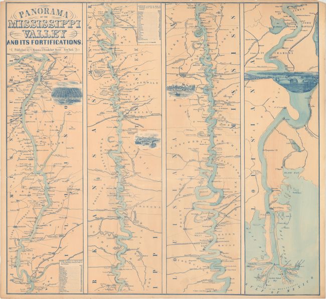
This great Civil War map is in the strip-map style on four panels. The map shows the course of the Mississippi River from its confluence with the Missouri River south to its delta on the Gulf of Mexico. There is excellent detail throughout as it locates towns and villages, forts, railroad lines, tributaries, and islands. Beside St. Louis, Memphis, Vicksburg, and New Orleans are finely rendered birds-eye views of the cities. The two distance tables include distances obtained by steamer. This a nice example of this map, which is usually found in rough condition. Blank verso.
References: Stephenson (Civil War) (2nd ed.) 42.5.
Condition: B+
There are a few small light dampstains at top and a short edge tear at left that has been closed on verso with archival tape. A few tiny edge chips at top just touch the border.