Catalog Archive
Auction 163, Lot 180

"Map of the Lands Known as the M. & O.R.R. Lands, in Alabama and Mississippi...",

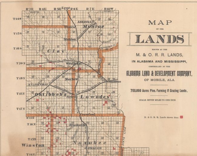
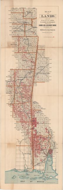
Subject: Alabama & Mississippi

Period: 1890 (circa)

Publication:

Color: Printed Color

Size:
11.1 x 36.8 inches
28.2 x 93.5 cm
Download High Resolution Image
(or just click on image to launch the Zoom viewer)

This very uncommon folding map depicts lands controlled by the Alabama Land and Development Company along the Mississippi-Alabama border. Mobile and Ohio Railroad lands are shaded in red. Counties and cities are named, and there is some navigational detail in the Mississippi Sound and Mobile Bay. Printed by Woodward & Tiernan in St. Louis.

References:

Condition: B+

Issued folding with a few short fold separations at fold intersections, light overall toning, and two small areas of moderate toning.

Estimate: $150 - $180

Unsold

Closed on 6/14/2017

Archived