Subject: Southern United States
Period: 1800 (circa)
Publication: Carey's General Atlas
Color: Hand Color
Size:
15.7 x 8.9 inches
39.9 x 22.6 cm
Mathew Carey was a seminal figure in early American publishing; establishing the first publishing firm to specialize in cartography and issuing the first atlas devoted exclusively to American maps. He set up an elaborate cottage system of craftsmen for compiling, engraving, printing, and coloring maps. This practice was emulated by later American cartographic publishers such as John Melish and Henry S. Tanner. The American Atlas concept was also adopted by other publishers in both the United States and Europe.
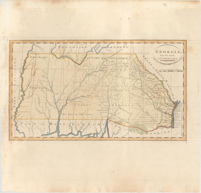
This scarce and significant map covers from the Atlantic seaboard to the Mississippi River; present-day Georgia, Alabama and Mississippi. There is good topographical information particularly in the eastern section, where early counties in Georgia are named and their boundaries given. The interior is labeled Country of the Creek Nation of Indians with several other tribes located and the notation These Parts are little known. Several Creek and Cherokee villages are located and the trading paths to the interior are shown. This is the second state issued in Carey's General Atlas with the number "39" added to the top left corner of the plate.
References: Wheat & Brun #611; cf. Phillips (Maps) p. 296.
Condition: B+
On watermarked paper with light offsetting and minor foxing. A few minor edge tears confined to the blank margins have been closed on verso with archival tape.