Subject: Colonial Southeastern United States
Period: 1755 (circa)
Publication: Atlas General
Color: Black & White
Size:
25.3 x 15.7 inches
64.3 x 39.9 cm
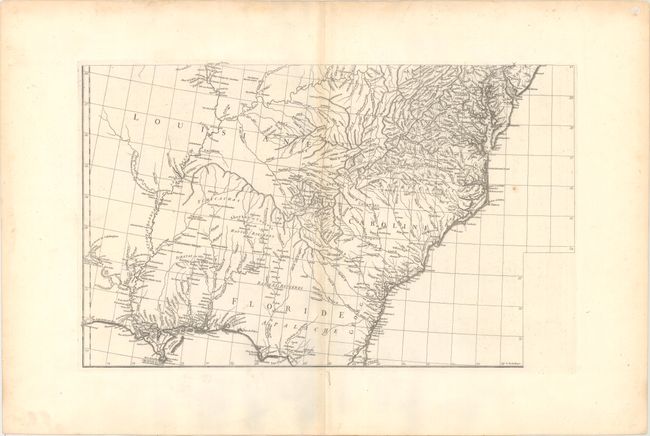
This is the southeastern sheet of D'Anville's four-sheet map of Eastern North America. It covers the region from west of the Mississippi River at Natchitoches to the east coast from St. Augustine north to Wilmington, Delaware. The map provides an excellent depiction of the river systems and topography, and locates numerous Indian tribes and place names along the coast.
The complete map was based in part on Mitchell's famous map of the United States which appeared earlier in the same year. D'Anville developed his version of the map with an emphasis on French influence on the area, omitting Mitchell's legend, references to English factories in the disputed trans-Allegheny area, and drew on French sources for additional details over the Mitchell map.
References: Sellers & Van Ee #17; Cumming (SE) #296; Tooley (Amer) p. 316.
Condition: B+
A crisp impression on a watermarked sheet with wide margins. There is faint toning along the centerfold and sheet edges along with a few minor spots.