Catalog Archive
Auction 163, Lot 146

"A New & Accurate Map of the Provinces of North & South Carolina Georgia &c. Drawn from Late Surveys and Regulated by Astonl. Observatn.", Bowen, Emanuel

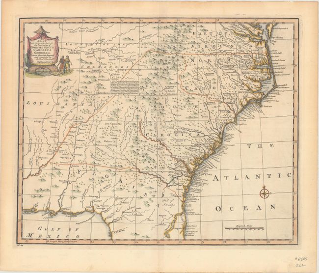
Subject: Colonial Southeastern United States

Period: 1747 (circa)

Publication: A Complete System of Geography

Color: Hand Color

Size:
16.8 x 13.7 inches
42.7 x 34.8 cm
Download High Resolution Image
(or just click on image to launch the Zoom viewer)

This detailed map covers the region from Chesapeake Bay to St. Augustine, Florida and west to Pensacola Bay and the Country of the Cherokees. The map is derived from the Carolina sheet of Popple's great twenty-sheet map of North America (1733). It is most notable for its placement of forts and Indian villages. It also includes information on towns, early forts, mines, and several English Factories. Text at center describes the alliance made by the British with the Cherokees to provide a buffer against French and Spanish military advances.

References: McCorkle (18th C. Geog. Books) #17-29 (Vol II); Cumming (SE) #263; Sellers & Van Ee #1380.

Condition: A

Nice impression and color with one tiny hole in the lower right corner of the image that is only visible when held to light. There are remnants of hinge tape on verso.

Estimate: $800 - $1,000

Sold for: $600

Closed on 6/14/2017

Archived