Catalog Archive
Auction 163, Lot 141

Hard to Find Map from Mitchell's First Edition American Atlas

"Map of Massachusetts Connecticut and Rhode Island Constructed from the Latest Authorities", Mitchell, Samuel Augustus

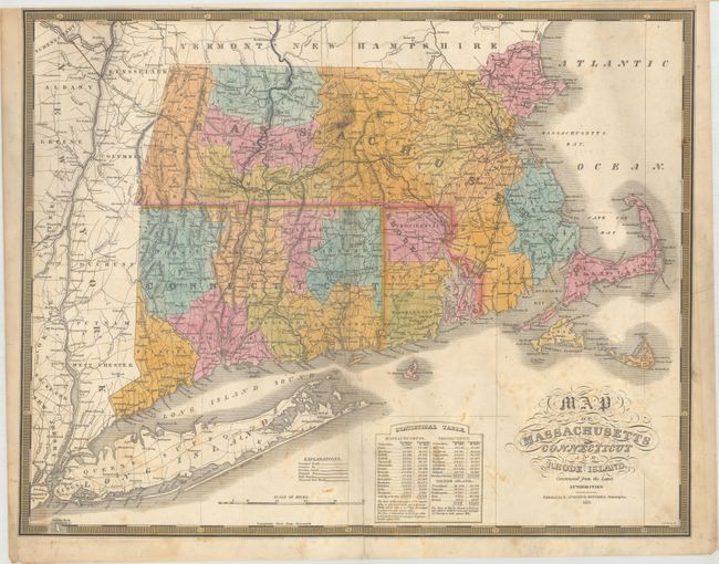
Subject: New England United States

Period: 1831 (dated)

Publication: A New American Atlas...

Color: Hand Color

Size:
21.5 x 16.9 inches
54.6 x 42.9 cm
Download High Resolution Image
(or just click on image to launch the Zoom viewer)

This map comes from Mitchell's first edition A New American Atlas, which utilized the plates from Finley's 1826 atlas of the same title with an updated publisher's imprint. It depicts counties, roads, proposed and existing canals & railroads, and locates scores of towns and villages. At bottom is a "Statistical Table" giving populations by county for 1810 and 1820. Engraved by J.H. Young.

References:

Condition: B

The map has been backed with tissue to reinforce and repair a number of centerfold separations and a few edge tears. An approximate 1" x 6" mostly blank section at the top center of the image has been professionally replaced in facsimile.

Estimate: $400 - $600

Sold for: $250

Closed on 6/14/2017

Archived