Subject: Eastern United States, Texas
Period: 1845 (circa)
Publication: Atlas Ancient & Modern
Color: Hand Color
Size:
10.1 x 8.2 inches
25.7 x 20.8 cm
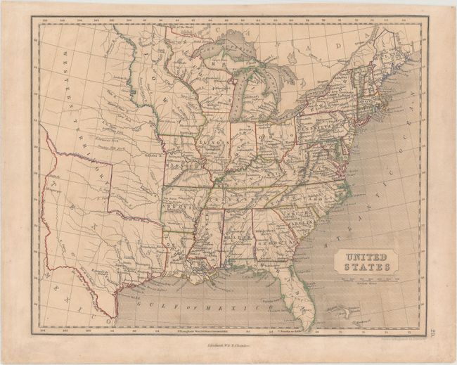
A very uncommon map of the United States featuring either the Republic of Texas or the new state shown in its largest configuration with a stovepipe boundary extending northwest to include Santa Fe. Wisconsin and Iowa territories are both greatly enlarged and stretch to the Canadian border. The huge Western Territory claims all those regions that would become Oklahoma, Kansas, the Dakotas, Wyoming and Montana, and is devoid of information in the far west with only rivers noted in the eastern portion. J. Gellatly was active in the 1840s and 1850s. William and Robert Chambers were active between 1845 and 1895, their first known atlas being published in 1845.
References:
Condition: B+
Original outline color with light toning and soiling.