Subject: North America, Texas
Period: 1841 (dated)
Publication: Atlas Universel
Color: Hand Color
Size:
15.1 x 19.7 inches
38.4 x 50 cm
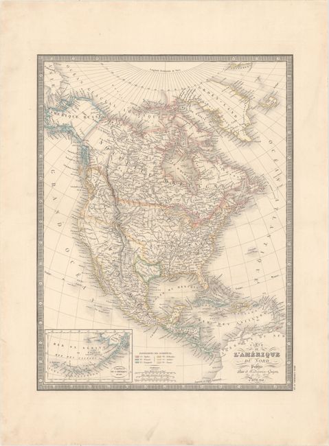
This 19th century map of the continent shows the United States in an evolving configuration. The boundary between the United States and Canada reflects the United States claims in the disputed Oregon Territory, with the border drawn along the 54th parallel. The independent Republic of Texas is shown in its smaller configuration along the Nueces River, and Mexico is control of the Southwest and California. Alaska is named Amerique Russe. The map shows good detail of settlements, rivers and the locations of Indian tribes, but does not show state or territorial boundaries. At lower left is an inset of the Aleutian Islands and Bering Sea.
References:
Condition: A
A crisp impression with original outline color. There is minor soiling confined to the blank margins.