Subject: Colonial North America
Period: 1710 (circa)
Publication:
Color: Hand Color
Size:
23.5 x 17.8 inches
59.7 x 45.2 cm
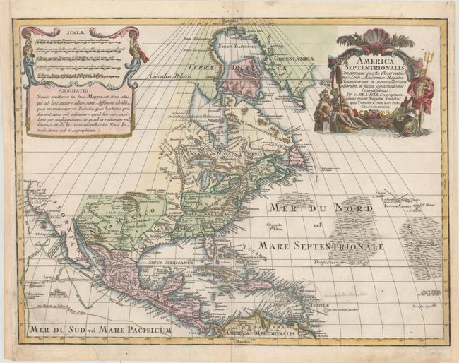
This attractive map is a very scarce German version of Guillaume Delisle's foundation map of North America (1700). The Great Lakes are based on the Coronelli model showing the French strong points at Tadousac, Quebec, Fort Sorel, Montreal and Fort Frontenac. The English settlements are confined along the eastern seaboard with the region around the Great Lakes and north of the Ohio River being the domains of the Ilionensium and Iroquoens. As with Delisle's map the Mississippi River is properly aligned, as are the Rio Grande and Colorado rivers, and California appears as a peninsula. Numerous tracks in the Pacific show the routes of different voyages. The Sargasso Sea is graphically shown in the Atlantic. Graphically the map copies both the title and the sales & notations cartouches.
References: McCorkle #700.4; Portinaro & Knirsch CXXIV.
Condition: B
Nice impression and color with the side margins extended to better accommodate framing with a tiny portion of the bottom right border in facsimile. The lower left corner of the map image was torn and reattached using archival material on verso, along with one edge tear and several small fold separations at bottom. There are a number of faint manuscript notations primarily in the West Indies.