Subject: Exploration & Surveys, South America, Pacific Ocean
Period: 1753 (published)
Publication:
Color: Black & White
Size:
3.9 x 6.8 inches
9.9 x 17.3 cm
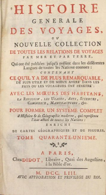
This is the forty-first volume of Didot's Histoire Generale Des Voyages... published in 1753. The volume is dedicated to the South Pacific and South America and contains the following four maps:
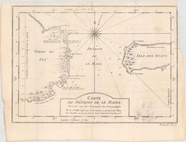
Carte du Detroit de le Maire... (10.8 x 7.7"). This chart illustrates this important passage between the Atlantic and Pacific oceans. Jacob Le Maire and Willem Schouten discovered the strait in 1616, which was a much less treacherous route than the Strait of Magellan, and opened up a new trade route for the Dutch. The map is adorned with a fine compass rose. Condition: Light offsetting with a small repaired biding tear at right. (B+)
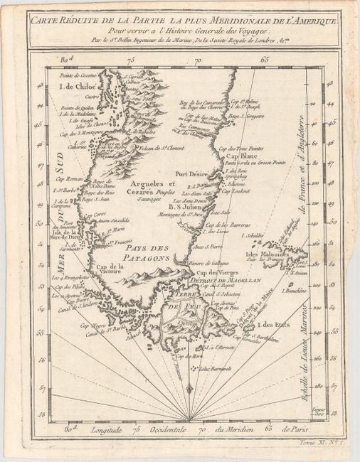
Carte Reduite de la Partie la Plus Meridionale de L'Amerique (6.7 x 9.0"). An attractive map of the southern tip of the continent, Tierra del Fuego and the Falkland Islands. Condition: Near fine. (A)
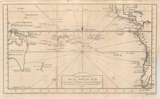
Carte Reduite de la Mer du Sud (14.3 x 8.3"). This map of the South Pacific presents nice detail of the region. Eastern Australia is shown with dotted lines connecting both Tasmania and New Guinea in a conjectural coastline. New Zealand is shown with only the western coastline demarcated. The Americas are shown from Baja California through Central America and the western coastline of South America including the Straits of Magellan and Cape Horn. Condition: Light toning, offsetting, and a small repaired hole and repaired 1.5" binding tear at right. (B)
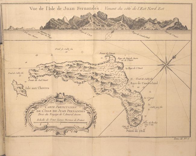
Carte Particuliere de l Isle de Juan Fernandes (10.9 x 707"). Small map of the Chilean Juan Fernandez Island, topped by a view of its rocky profile. The map was based on Admiral George Anson's voyage in 1740, when he set sail in command of a squadron sent to attack Spanish possessions and interests in South America. The expedition was ill-equipped and failed to carry out its original ambitious mission, but later gained the reward of the capture of an immensely rich prize, the Nuestra Senora de Covadonga, which he encountered off Cape Espiritu Santo on June 20, 1743. Condition: Faint offsetting and a repaired binding tear at left. (B+)
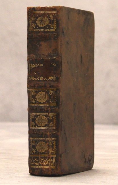
550 pages with 4 maps and 3 plates. 12mo, hardbound in full calf with raised bands on spine.
References:
Condition:
See description above for details of the maps, which are all issued folding. Three of the four maps are separated from the text, which is clean, bright, and near fine. The spine is cracked and missing its title label, and the covers have moderate wear.