Subject: Atlases
Period: 1780 (circa)
Publication:
Color: Black & White
Size:
8.1 x 10.3 inches
20.6 x 26.2 cm
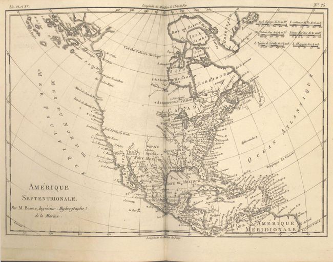
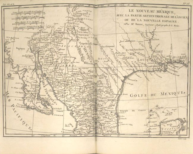
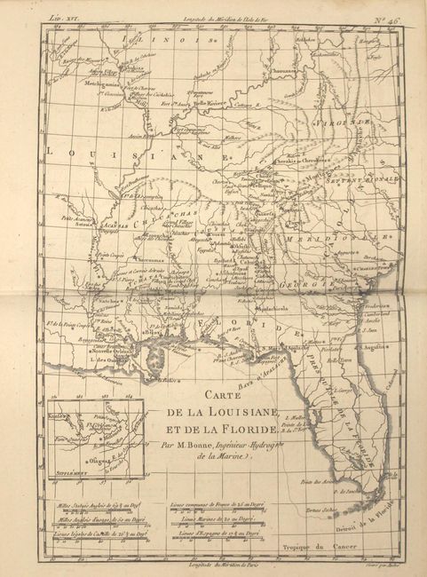
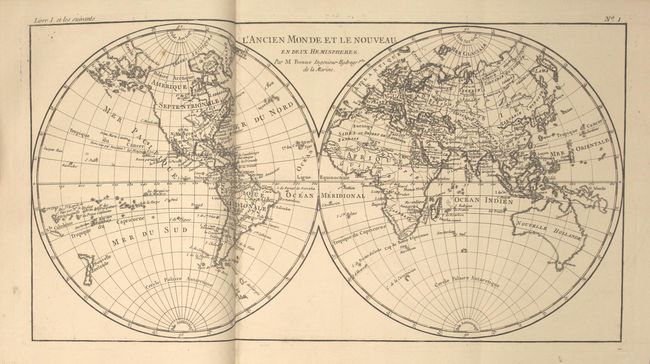
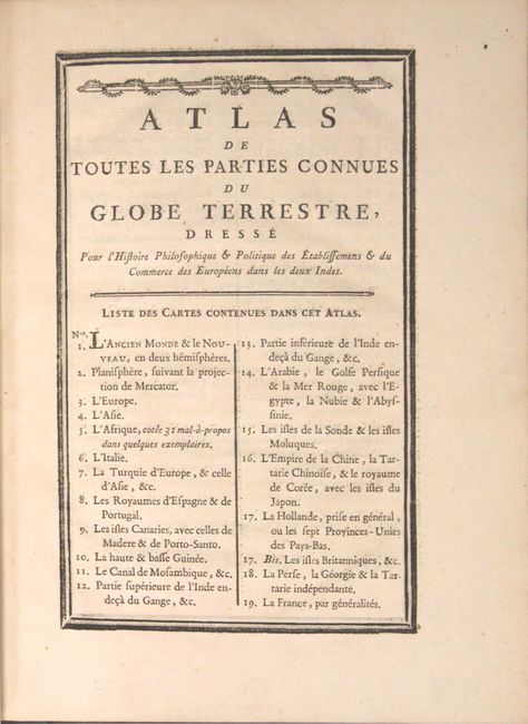
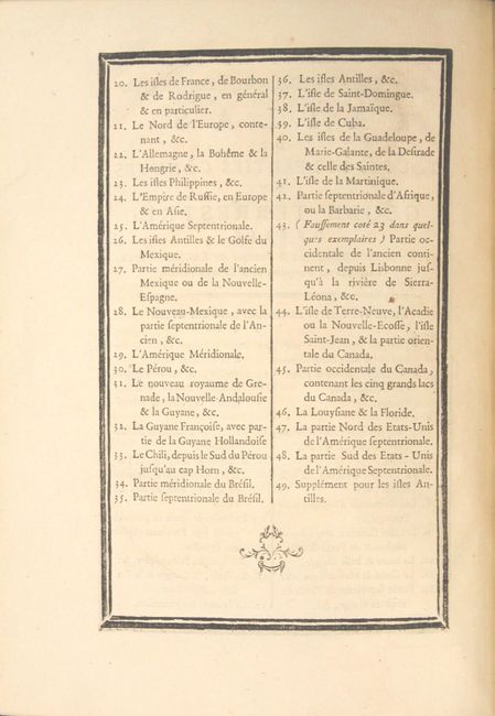
This is the complete atlas volume for Abbe Raynal's "L'Histoire Philosophique et Politique des Etablissemens et du Commerce des Europeens dans les Deux Indes" and is filled with Bonne's well-drawn maps and charts engraved by Andre. Included are a title page, list of maps, Analyse Succincet de Cet Atlas (28 pp.), and 50 maps. The map contents include two world maps, Europe, Asia, Africa, ten related to Europe, three related to Africa, two related to India, Arabia, the East Indies, the Moluccas, China, Persia, Philippines, Russia, six related to South America, several Caribbean charts, plus North America and those related: Mexico; le Nouveau Mexique; Terre-Neuve, Acadia...; Occidentale du Canada; Louisiana & Florida; Partie Nord des Etats Unis; and Partie Sud des Etats Unis.
In the North America map, the entire western part of the continent is left mostly blank. Indian tribes occupy the edges of the defined territory -- Apaches, Sioux, Outagamis, and Assenipouels. The British Colonies and a few major cities are named along the eastern seaboard and in the Great Lakes region. Alaska is shown as a group of islands, the largest of which is labeled Alaschka.
The map of Mexico and the Southwest U.S. details the region from West Florida through California and northern Mexico. In Texas, there is a city named Texas and a notation concerning the death of the explorer La Salle. There is excellent detail, particularly of the Jesuit missions in Mexico and the Southwest. In present-day Arizona, the Gila River is named Rio de los Apostolos. The map is filled with place names and Indian villages, particularly in today's Arizona and New Mexico. The Baja peninsula is wildly misshapen.
The map of the American Southeast and the Mississippi River Valley extends from Charleston, South Carolina west to include New Orleans and north into southern Illinois. Being a French-produced map, Louisiana extends to the Appalachian Mountains bordering the southern colonies. The Mississippi and Ohio Rivers are well delineated. Florida is shown with its panhandle extending west to include Mobile and Biloxi. Locates Charles Town, Savannah, St. Augustine, Mobile, Pensacola, and several far western settlements and forts in the frontier. A small inset provides details of the Missouri River.
Full original mottled calf with gilt embossing, raised bands on spine with gilt decoration and red and green leather title labels, original ribbon page marker, and all edges gilt. The atlas volume did not carry any publication information on the title pages, but was known to be published in 1780.
References:
Condition:
The maps are all clean and bright, with most in near fine (A) condition, and the remainder in very good (B+) condition with light offsetting and occasional spots of foxing or soiling. The binding is tight, the covers show very light wear, and the spine is just beginning to crack. A very nice presentation example.