Subject: Southeast Asia
Period: 1944 (dated)
Publication:
Color: Printed Color
Size:
57.3 x 38.3 inches
145.5 x 97.3 cm
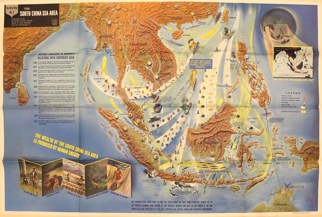
This very large pictorial map was produced by the Educational Services Section of the U.S. Navy. It depicts a host of wartime events along with a history of United States relations with Asia from 1784-1925 at left. The map vividly shows numerous Japanese invasion routes in yellow and their supply lines in white along with a note at center indicating "Jap Supply Ships Loaded with Booty from Conquered Countries, sunk by U.S.N. submarines." Numerous battle scenes are depicted throughout including the sinking of H.M.S. Repulse, H.M.S. Prince of Wales, and H.M.S. Langley. General MacArthur's route from the Philippines to Australia is shown at right. The map is further decorated with several illustrations at lower left demonstrating "The Wealth of the South China Sea Area is Produced by Human Energy." A vivid depiction of the events in the Pacific theater of war.
References:
Condition: A
Bold color on a clean sheet with a few small separations at fold intersections.