Catalog Archive
Auction 162, Lot 600

"An Accurate Chart of the Mediterranean and Adriatic Seas; with the Archipelago & Part of the Black Sea Exhibiting All the Islands in Those Seas...", Bowen, Emanuel

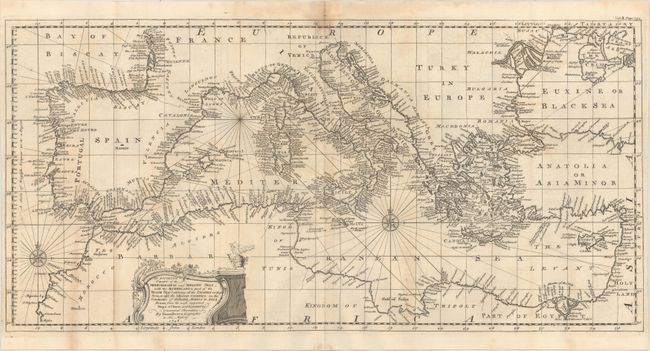
Subject: Mediterranean

Period: 1748 (dated)

Publication: John Harris' Navigantium Atque Itinerantium Bibliotheca...

Color: Black & White

Size:
22.9 x 11.2 inches
58.2 x 28.4 cm
Download High Resolution Image
(or just click on image to launch the Zoom viewer)

A highly detailed chart covering the entire Mediterranean from Gibraltar east to Cyprus and the mouth of the Nile River. It extends further north to cover the Adriatic and Black Sea. The map is filled with place names along the coast, numerous islands, and is decorated by two compass roses, each topped with a fleur-de-lis and an ornamental title cartouche in the interior of Africa.

References: Shirley (BL Atlases) G.HARR-1a #25.

Condition: B

Issued folding with light uneven toning that is more prominent in the top blank margin.

Estimate: $170 - $200

Sold for: $100

Closed on 4/26/2017

Archived