Subject: Cartographic Miscellany, United States Puzzle Map
Period: 1887 (dated)
Publication:
Color: Printed Color
Size:
17.7 x 11.5 inches
45 x 29.2 cm
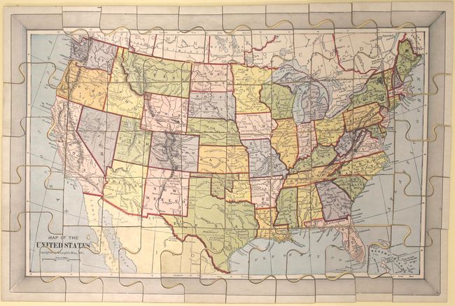
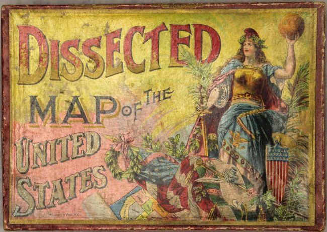
Terrific Victorian period map puzzle with original box. Complete with all pieces, box, and full color map to aid in assembling the puzzle. Many of these puzzles carry the date 1887 but were published later. This example was published sometime around 1890 or shortly thereafter given that Dakota Territory is now shown divided into the states of North and South Dakota. The original paper label on the box is reminiscent of a cigar box label as it combines the printing processes of multi-stone chromolithography, solid color zinc plate, and gold stamping to produce a beautiful image.
McLoughlin Bros., Inc. was a New York publishing firm that pioneered the systematic use of color printing technologies in children's books, particularly between 1858 and 1920. The firm's publications served to popularize illustrators including Thomas Nast, William Momberger, Justin H. Howard, Palmer Cox, and Ida Waugh. By 1886, the firm published a wide range of items including cheap scrapbooks, large folio picture books, linen books, puzzles, games and paper dolls. It is rare to find a nineteenth century puzzle with all pieces and in excellent condition.
References:
Condition: A
The puzzle is near fine with very minor surface soiling. The folding guide map is unusually clean and bright. The box has some minor wear with a slightly concave cover as is typically seen.