Subject: Central Europe
Period: 1851 (circa)
Publication: Illustrated Atlas and Modern History of the World
Color: Hand Color
Size:
13 x 9.9 inches
33 x 25.1 cm
The maps from The Illustrated Atlas were first published in serial form to a target audience that led insular lives due to the expense and hardship of travel. All that changed as the progress of the nineteenth century brought swift and dramatic changes in public awareness of far away places. Tallis' maps no doubt played an important role in this dramatic awakening. These maps not only provided up-to-date geographical knowledge, but also used vignette views within the map's design to show the native people and their occupations, cities and points of interest. The maps hark back to a cartographic tradition from the Dutch mapmakers of the seventeenth century with finely engraved decorative borders. The maps were drawn and engraved by John Rapkin with views drawn and engraved by a number of prominent artists. The maps were issued as a complete volume from 1851 until about 1865. Some of the maps were also published in other history books published by Tallis including British Colonies and, without the vignettes, in geographical dictionaries and encyclopedias until about 1880.
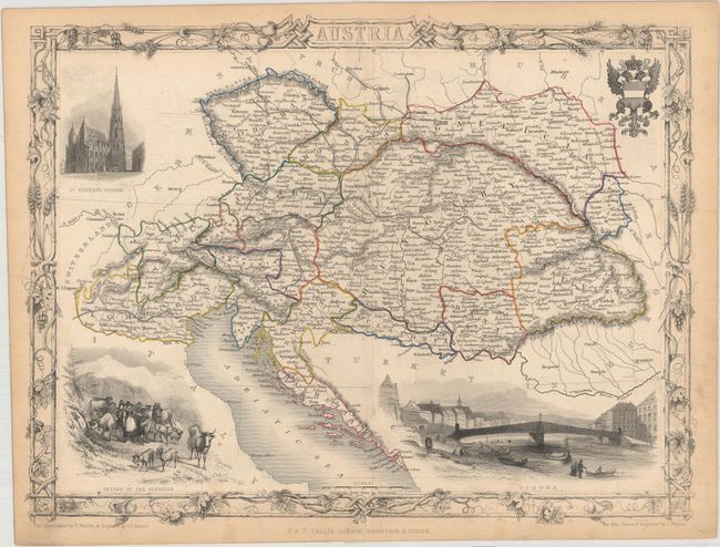
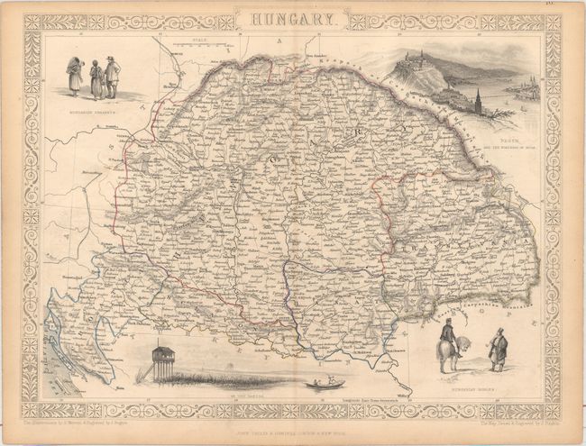
Both maps were drawn and engraved by J. Rapkin and are surrounded by decorative borders.
A. Austria. This attractive steel engraved map includes vignettes drawn by H. Warren and engraved by J.H. Kernot. The map is centered on Vienna and extends to Northern Italy in the west and Transylvania in the east. Embellished with several finely engraved vignettes: "St. Stephens, Vienna," "Return of the Sennerin," "Vienna," and a fancy coat-of-arms.
B. Hungary. This handsome map of Hungary features vignettes drawn by H. Warren and engraved by J. Rogers: "Hungarian Nobles", "On the Danube", "Hungarian Peasants", and "Pesth and the Fortress of Buda." The map was published before 1873, so Buda and Pest remain separate cities.
References:
Condition: B+
Both maps have original outline color. There are a few tiny spots, minor offsetting, and light toning along the centerfold and sheet's edges. On the Austria sheet there is a short centerfold separation at bottom that has been closed with tape on verso.