Catalog Archive
Auction 162, Lot 476

"Carte Reduite des Costes de Flandre et de Hollande Depuis le Pas de Calais Jusqu'a l'Elbe, et les Costes d'Angleterre...", Bellin, Jacques Nicolas

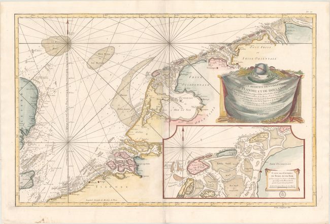
Subject: Low Countries

Period: 1763 (dated)

Publication: L'Hydrographie Francoise

Color: Hand Color

Size:
34.1 x 22 inches
86.6 x 55.9 cm
Download High Resolution Image
(or just click on image to launch the Zoom viewer)

This oversized sea chart depicts the coastline from Calais, France to the mouth of the Elbe River in Germany. The chart is filled with soundings, sand bars, water currents, anchorages, and navigational information, and extends across the North Sea to include the southeastern coastline of England. A large inset depicts the area around Texel and Vlieland. The chart is adorned with a large drape-style cartouche featuring a globe, anchor, and oars. The engraved seal of the Depot de la Marine is at bottom right, with the price below the neatline: Prix. Cinquante Sols.

References:

Condition: A

On sturdy paper with a large eagle watermark, a professionally repaired tear that just enters the map border at bottom center, a few soft creases, and marginal soiling.

Estimate: $400 - $500

Unsold

Closed on 4/26/2017

Archived