Subject: Baltic
Period: 1601 (published)
Publication: Epitome Theatri Orteliani
Color: Hand Color
Size:
4.4 x 3.2 inches
11.2 x 8.1 cm
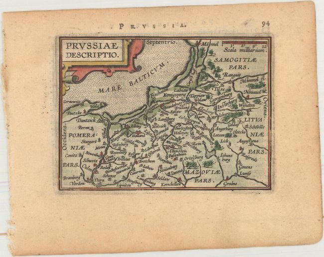
Miniature map of the Prussian Empire, which takes in part of present-day Poland, with Lithuania and the Russian enclave of Kaliningrad (here Konigsperg). It is embellished with a strapwork title cartouche and stipple engraved sea. Latin text on verso.
This map was published in Filips Galle's series of Epitome, which first appeared in 1588. Galle was unimpressed with the maps in the Spieghel der Wereld, and therefore gradually replaced nearly all of them through the various editions of his Epitome. The new maps had simple double-lined borders and were widely copied by others. The plates were acquired by Jan Baptist Vrients circa 1600, who published three more editions in 1601 and 1602, retouching some of the plates and replacing a few more. By the time Vrients' 1601 edition was published, only 10 of the original maps remained.
References: King (2nd Ed.) pp. 64-65 & 88-89; Van der Krogt (Vol. III) #1720:332.
Condition: B+
A nice impression with light toning.