Subject: Britain
Period: 1720 (dated)
Publication:
Color: Hand Color
Size:
21.9 x 18.6 inches
55.6 x 47.2 cm
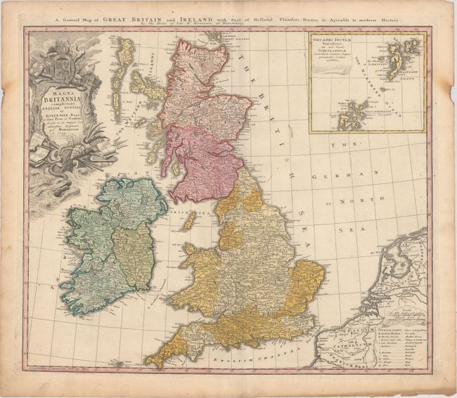
This handsome and uncommon map of the British Isles is filled with details on provinces, towns, and counties, with the Orkney Islands included in an inset at upper right. A table at the lower right includes symbols for cities, market towns, bishoprics, roads, ferries and bogs, among other places of note. The richly decorated cartouche is topped with the crest of Britain. There is a second English title above the map, A General Map of Great Britain and Ireland with Part of Holland, Flanders, France &c. Agreeable to Modern History.
References:
Condition: B+
Original color with minor soiling, a few small rust spots, and a printer's crease running along the centerfold. In the blank margins there are burn marks at left and right, light toning along the edges of the sheet, and a short centerfold separation at bottom.