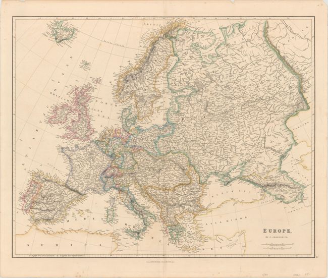
Subject: Europe
Period: 1840 (dated)
Publication: The London Atlas of Universal Geography
Color: Hand Color
Size:
23.6 x 18.9 inches
59.9 x 48 cm
This detailed map of the continent spans from Iceland to the Caspian Sea. It features many towns, cities, and roads as well as fine topographical detail. Locations of notable sea battles are indicated by crossed sabers and the year of the battle. Germany is divided into several states and nearly all of eastern and southeastern Europe is encompassed by the Austrian and Turkish empires. The map extends to include engraved portions of northeast Africa, Tartary, Turkey, and Cyprus.
References:
Condition: B+
Original outline color with some light spots and minor offsetting. The sheet has short edge tears confined to the blank margins.