Subject: Barbados
Period: 1780 (dated)
Publication:
Color: Hand Color
Size:
15.4 x 13.6 inches
39.1 x 34.5 cm
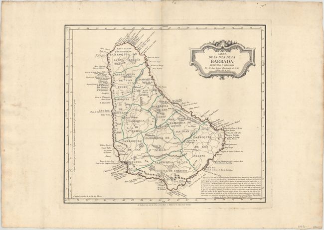
This rare chart of Barbados was published in Madrid by Don Tomas Lopez de Vargas Machuca (1730-1802), Geographer to the King of Spain and one of the most distinguished Spanish cartographers of the eighteenth century. The chart divides the island into 11 parishes and has several place names especially concentrated along the coastline. Rivers, roads, and topographical detail are depicted. Sn. Miguel, o Bridge Town, the capital and largest city of Barbados, is shown in Carlisle Bay. A number of churches are name throughout the island. Some basic navigational information, including hazards and anchorages, appear in the water. At bottom right a block of Spanish text discusses the mapping of the island with mentions to Bellin and Emanuel Bowen. A lovely decorative title cartouche adorns the top right corner.
References: Campbell (MCC-21) #39; Shirley (BL Atlases) #T.LOP-3a Vol. 2 #25.
Condition: A
A fine impression with original outline color and a "R Rumeu" watermark. There is minor toning along the centerfold, marginal soiling, and a small damp stain that just enters the border at top.