Subject: Lesser Antilles
Period: 1780 (circa)
Publication: La Harpe's Histoire Generale des Voyages
Color: Hand Color
Size:
11.9 x 7.8 inches
30.2 x 19.8 cm
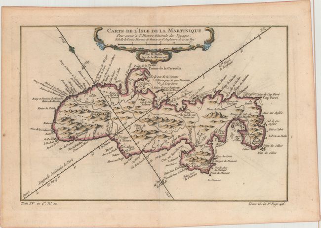
A. Carte de l'Isle de la Martinique..., dated 1758. Delicately detailed map of the island showing mountains, roads, towns, forts, anchorages, and dozens of place names. Exhibiting fine coastal detail, the chart locates Sac Marin, Bourg de la Rivieree Pilote, Se. Luce, Fort Royal, Fort S. Pierre, the Pitons du Vauclain, roads, watershed, graphic topography, shoals, and anchorages. Decorated with a rococo-style cartouche and fleur-de-lys incorporating a distance scale.
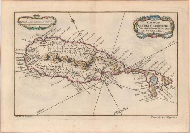
B. Carte de de l'Isle St. Christophe..., circa 1780. This lovely map of St. Kitts is fully engraved with mountains, rivers, lakes, and towns. The island has twelve quarters and parishes. In the center of the island a note on the mountain Mont Misery locates Mines de Souffre. Grande Saline, Ville de la Basse Terre, forts, churches, and more are identified. Decorated with baroque-style title and scale of miles cartouches and a fleur-de-lys, all fully colored. Ref: cf. Tooley (MCC-81) St. Christopher #33.
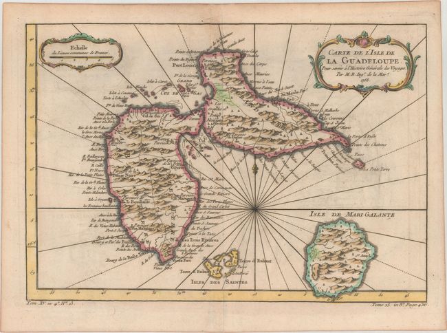
C. Carte de l'Isle de la Guadeloupe..., dated 1758. A very handsome, small map adorned with rhumb lines, fleur-de-lys, and two decorative rococo-style cartouches. Filled with good detail and place names throughout. Also includes the islands of Marie-Galante and the Iles des Saintes.
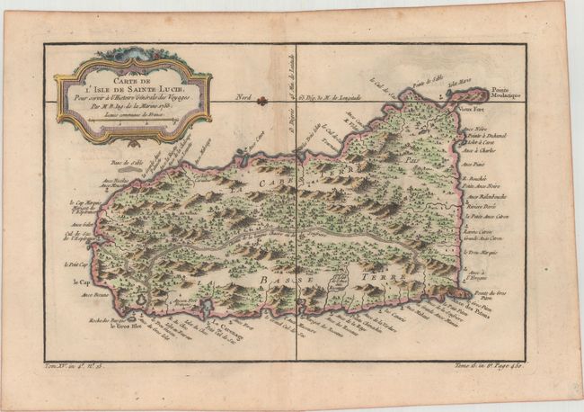
D. Carte de l'Isle de Sainte Lucie..., dated 1758. This map of St. Lucia divides the island into the region controlled by the native Caribs and the colonial sugar plantations. It includes a decorative title cartouche and is fully engraved with mountains, forests, rivers, roads, towns, and anchorages. A fleur-de-lis orients the map with north to the left.
References:
Condition: B+
On watermarked paper with light offsetting, some faint spots, and minor toning along the centerfolds and edges of the sheets.