Subject: Jamaica & Hispaniola
Period: 1780 (circa)
Publication: Histoire Generale des Voyages
Color: Hand Color
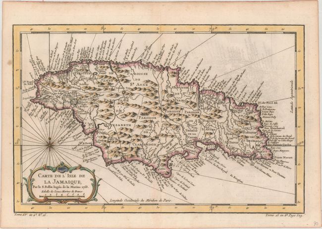
A. Carte de l'Isle de la Jamaique, dated 1758 (12.6 x 8.1"). Strongly engraved map describes this island of the Greater Antilles. Divided by parishes, the map shows remarkable detail with scores of place names along the coast plus mountains, personal estates, watershed, and other details in the interior. At lower left is a decorative rococo-style title cartouche with compass rose and rhumb lines above. Ref: Kapp (MCC-42) #77; Sellers and Van Ee #1917.
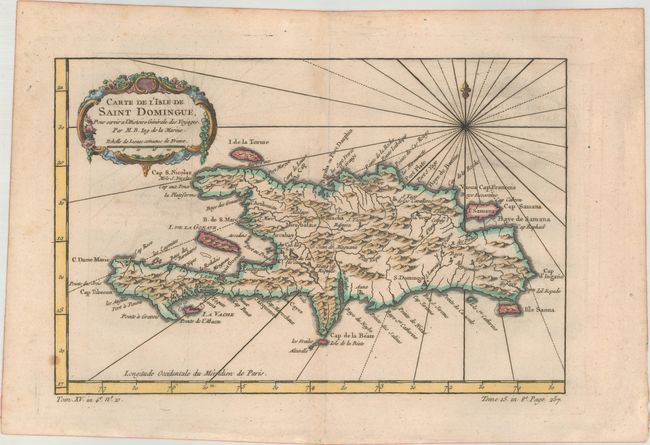
B. Carte de l'Isle de Saint Domingue, pour Servir a l'Histoire Generale des Voyages, (11.5 x 7.6"). This copper-engraved map of Hispaniola names several capes, ports, and bays running along the coast of the island, as well as identifying numerous towns and rivers inland. A compass rose capped with a fleur-de-lis radiates rhumb lines and a title cartouche draped in garlands adorns the upper left corner. Ref: Sellers and Van Ee #1851.
References:
Condition: B+
Both sheets are on watermarked paper with crisp impressions and light offsetting. There are a couple minor spots on the Hispaniola map.