Subject: World, World War II
Period: 1944 (dated)
Publication:
Color: Printed Color
Size:
45.9 x 32.9 inches
116.6 x 83.6 cm
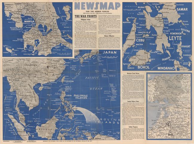
This large-format map covers much of eastern and southeastern Asia. It is centered on the Philippines, where the Battle of Leyte had just begun under the direction of General MacArthur. Two additional inset maps provide greater detail of the region around Manilla and the islands surrounding Leyte. The three month Leyte campaign ended with American victory and Japanese forces had to concede these very strategic islands to the Allies. Also included are two smaller inset maps showing the European theater of war. This "Newsmap" was issued on Monday, October 30th, 1944, and covers the news from October 18-25, 1944 - the 268th week of the war. Prepared by the Army Information Branch and issued by the U.S. Government Printing Office.
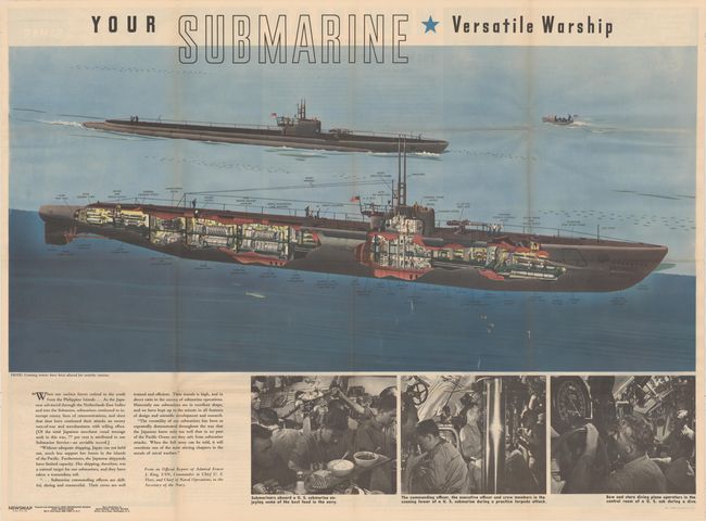
The verso of this "newsmap" contains a very interesting cutaway of a submarine measuring approximately 42" long. The illustration provides the reader with a representative view of the inside workings, and additional photo illustrations below depict daily life aboard the vessel.
From 1942-46, the U.S. Army published "newsmaps" to keep American troops updated on the war. These weekly posters were distributed and posted in every American installation in the world and were intentionally more visual than descriptive to help engage and motivate personnel.
References:
Condition: A
A clean, colorful example with a few minor splits at fold intersections that have been closed on verso with archival tape and one tiny hole and abrasion along the right fold.