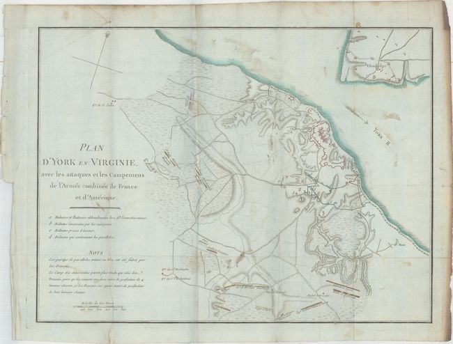
Subject: Yorktown, Virginia
Period: 1787 (published)
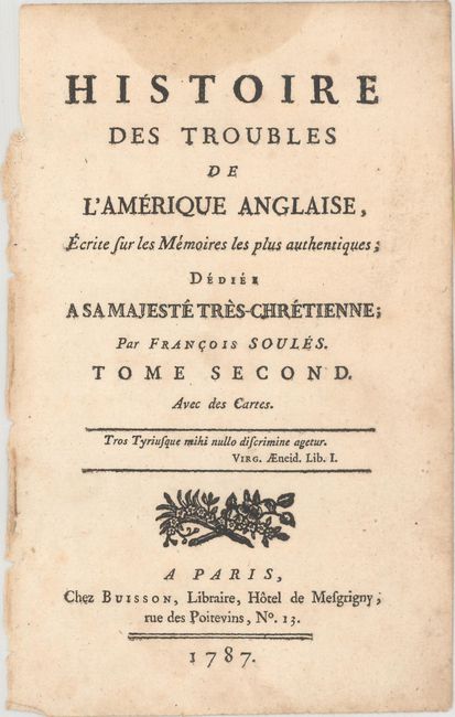
Publication: Histoire des Troubles de l'Amerique Anglaise...
Color: Hand Color
Size:
15.1 x 11.3 inches
38.4 x 28.7 cm
This uncommon and unusual Revolutionary War period map of the battle of Yorktown was one of three issued in Francois Soules' Histoire des Troubles de l'Amerique Anglaise. The Battle of Yorktown decided the course of the war and the future of the United States. The map shows the positions of British, American and French troops and fortifications at Yorktown and Gloucester. There is good detail of the roads, watershed, and topographical information. The French and American positions are named, and the headquarters of General Washington and Rochambeau are noted. A simple compass rose orients north to the top right.
The map is accompanied by the title page to volume 2 of Soules' Histoire des Troubles de l'Amerique Anglaise.
References: Nebenzahl (Biblio) #198; Howes #S770.
Condition: B
Issued folding on bluish, watermarked paper with original color, moderate soiling, a few misfolds, and a binding tear that is confined to the left blank margin. The right edge of the sheet appears to have some smoke damage, which is well away from the image.