Subject: Tennessee & Kentucky
Period: 1834 (dated)
Publication: HR Doc. 171, 23rd Congress, 2nd Session
Color: Black & White
Size:
28.2 x 16.2 inches
71.6 x 41.1 cm
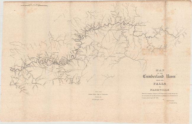
This uncommon map was issued in Stansbury's report concerning the practicability of extending steamboat navigation up the Cumberland River. The map follows the course of the Cumberland River to near its source in Kentucky naming Nashville, Rome, Carthage, Williamsburg, Burksville and more along the route. Also locates the towns of Jamestown, Liberty, Monticello and Burkesville as well as noting the head of steamboat navigation just below a 56 foot waterfall. The map has good detail within 30 - 50 miles of the river showing towns, roads and waterways. The geography was taken from Matthew Rheas Map of Tennessee and was drawn by Randolph Coyle.
References: Claussen & Friis #44.
Condition: B
Light scattered foxing and staining that is more pronounced along the right fold. Issued folding.