Subject: Oklahoma
Period: 1903 (dated)
Publication:
Color: Printed Color
Size:
25.9 x 19 inches
65.8 x 48.3 cm
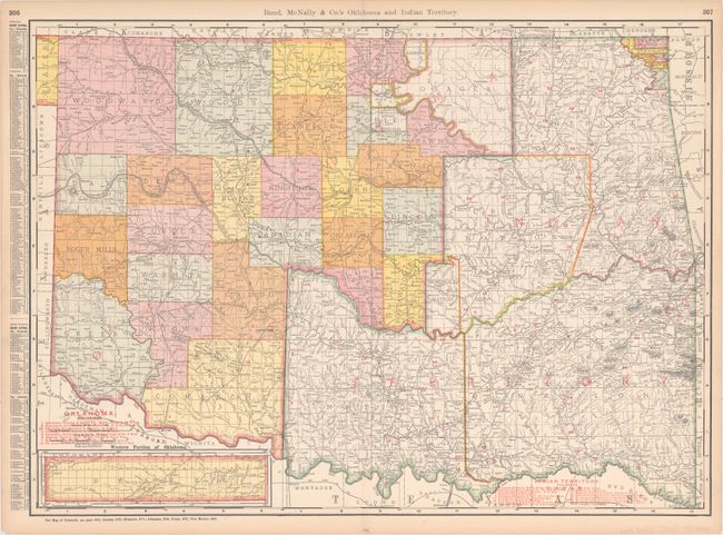
This detailed map shows the territory divided into Oklahoma in the west and Indian Territory in the east. Indian Territory is split up between the Five Civilized Tribes (Cherokees, Creeks, Seminoles, Chickasaws, and Choctaws) and the Osages. County configuration in the Oklahoma Territory is current to 1904 with Noble County and the Poncas and Oto-Missouri reservations shown. Railroads are indicated by red overprinting, with 8 identified in Oklahoma and 16 in Indian Territory. An inset at bottom left details Beaver County. A list of chief cities runs down the left margin of the sheet.
References:
Condition: A
There are some minor stains, light toning, and short edge tears and centerfold separations, all confined to the margins with the exception of one edge tear that just enters the neatline at right.