Subject: Michigan
Period: 1850-55 (dated)
Publication:
Color: Hand Color
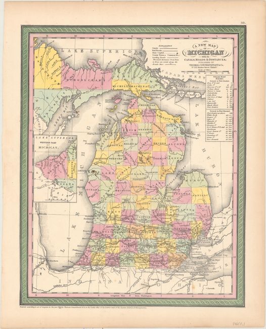
A. A New Map of Michigan with Its Canals, Roads & Distances, by Thomas, Cowperthwait & Co., dated 1850 (11.8 x 14.7"). Attractive, colorful map with county development throughout, but no settlement beyond Saginaw, with the notable exception of Mackinaw Island. Railroads are shown only in the extreme southern portion of the state. It includes an inset of the western tip of the Upper Peninsula, showing Ontonagon County and parts of Marquette, Houghton, and Delta counties. The table to the right gives the cities and distances along the steamboat routes from Detroit to Fort Gratiot and then continuing to Fort Howard. The map is adorned with calligraphic title and scroll borders.
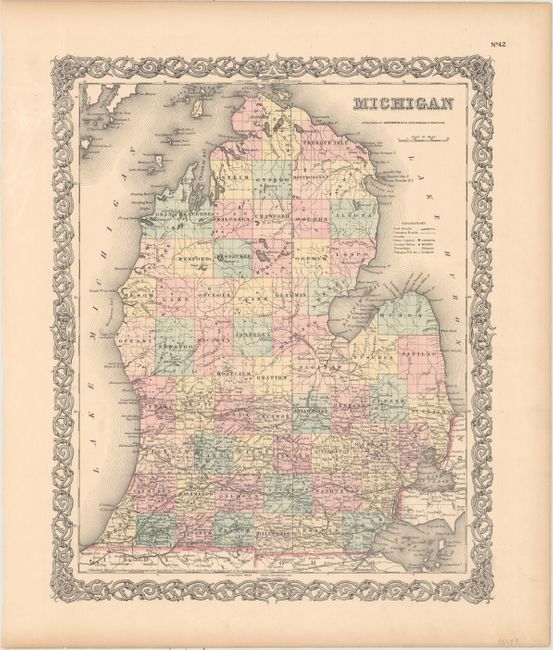
B. Michigan, by Joseph Hutchins Colton, dated 1855 (13.0 x 15.9"). Only the southern portion of Michigan is settled on this handsome map of the state. County configuration is current as indicated by the shape of Tuscola and La Peer. Railroads, roads, canals, towns, county towns, and villages are identifed. Surrounded by an elaborate decorative border.
References:
Condition: B+
Both maps have some light spots and marginal toning. The map by Colton has some extraneous creasing in the left blank margin.