Subject: Maine
Period: 1814 (circa)
Publication: American Pocket Atlas
Color: Hand Color
Size:
5.8 x 7.5 inches
14.7 x 19.1 cm
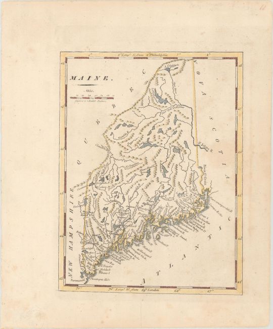
Mathew Carey was a seminal figure in early American publishing; establishing the first publishing firm to specialize in cartography and issuing the first atlas devoted exclusively to American maps. He set up an elaborate cottage system of craftsmen for compiling, engraving, printing, and coloring maps. This practice was emulated by later American cartographic publishers such as John Melish and Henry S. Tanner. The American Atlas concept was also adopted by other publishers in both the United States and Europe.
This is an uncommon later state of Carey's small map of Maine, originally published in 1796 under the title Province of Maine. Published just a few short years before it became a state in 1820, it includes Cape Neddick, Portland, Casco Bay, Monhegan Island, Bangor, and Sebago and Moosehead lakes. Additions to this state include double line wagon roads, Campo Bello, Prospect, and other place names. Engraved by Amos Doolittle.
References: cf. Wheat & Brun #174.
Condition: B+
There is light scattered foxing and a few minor extraneous creases.