Catalog Archive
Auction 162, Lot 24

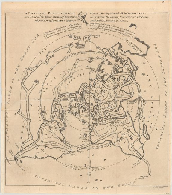
"A Physical Planisphere Wherein Are Represented All the Known Lands and Seas wth. the Great Chains of Mountains...", Cole, Benjamin

Subject: World

Period: 1757 (published)

Publication: Gentleman's Magazine

Color: Black & White

Size:
11.6 x 12.6 inches
29.5 x 32 cm
Download High Resolution Image
(or just click on image to launch the Zoom viewer)

Very unusual map projected from the North Pole to the Tropic of Capricorn within the sphere. The southernmost landmasses are then drawn outside the sphere with the "Antarctic Lands in the Ocean." The map depicts Buache's famous north polar projection showing his theory that the mountain ranges of the world are connected across the ocean basins. The map was issued in the March, 1757 Gentleman's Magazine to illustrate Buache's 3-page essay excerpted from his address to the Royal Academy of Paris.

References: Jolly #GENT-104.

Condition: B+

Issued folding and now flattened and backed with tissue to repair a nearly invisible 5" binding tear at left. There are a few minor spots of foxing and a binding trim at lower left has been replaced with old paper.

Estimate: $120 - $150

Sold for: $45

Closed on 4/26/2017

Archived