Subject: Alabama
Period: 1829 (circa)
Publication: A New General Atlas...
Color: Hand Color
Size:
8.7 x 11.3 inches
22.1 x 28.7 cm
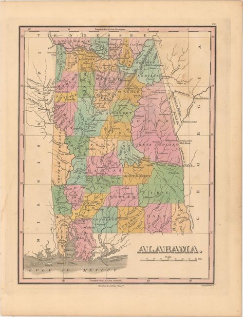
Finely's maps employ a delicate and elegant engraving style and provided extensive topographical and watershed information. He was the dominant map maker in the United States in the early 1820s into the 1830s. His atlases were very successful, outselling rival atlases by Carey & Lea, and Tanner. His maps were printed on high quality paper and were routinely corrected and updated.
A fine early map of the state with only 40 counties delineated. Two large regions in the east are unorganized and labeled Cherokee Indians and Upper Creek Indians. A boundary dispute between Georgia and Alabama is depicted in the northeastern part of the state with a "Line Claimed by Georgia" and a "Line Claimed by Alabama." Shows good detail of roads, trails, forts, towns and settlements. Engraved by Young & Delleker.
References:
Condition: B+
Original color with light scattered foxing at top.