Subject: Western United States
Period: 1853 (dated)
Publication: Mitchell's New Universal Atlas
Color: Hand Color
Size:
12.7 x 15.6 inches
32.3 x 39.6 cm
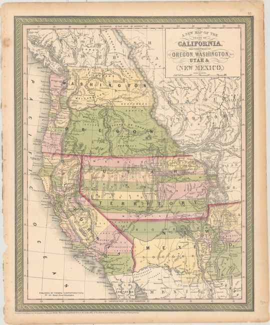
A great map of California and the large western territories from this important series of maps originating with Samuel Augustus Mitchell. The map is filled with early county configurations, the exploration routes of Lewis and Clark, Fremont, Kearney and Cooke, and the Spanish and Oregon Trails. Washington and Oregon have their eastern boundaries in the Rocky Mountains adjoining Missouri Territory and county development is confined to west of the Cascades. Utah Territory extends to Middle Park and Long's Peak in present-day Colorado where it borders Indian Territory. There are no settlements yet in the area of Denver, however St. Vrains Fort is located. New Mexico Territory encompasses parts of present-day Colorado and Arizona and displays a pre-Gadsden Purchase border along the Gila River. County development in California is well underway except in the south. Decorative scroll borders in the characteristic green color.
References:
Condition: A
Original color with light toning and soiling confined to the edges of the sheet, and a short tear at bottom left, not entering image. Remnants of hinge tape on verso.