Subject: Southern United States
Period: 1823 (circa)
Publication: A General Atlas Containing Distinct Maps of All the Known Countries in the World
Color: Hand Color
Size:
17.3 x 10.9 inches
43.9 x 27.7 cm
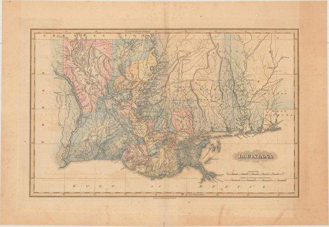
This is an updated version of William Darby's detailed map of Louisiana, and depicts the state just after the settlement of its western boundary with Mexico in 1819. The Adams-Onis Treaty, or Transcontinental Treaty, of 1819 was critical in defining the US-Mexico boundary. In the provisions of the treaty, the US ceded to Spain its claims to Texas, New Mexico and California in exchange for Spain's claims to east Florida and the Oregon Country north of the 42nd parallel (the present-day northern border of California). This map extends to show parts of Mississippi and Alabama and gives good detail of roads, rivers and the topography of the region, including the depiction of marshes along the coastline. Parish lines are current to circa 1820, just prior to the formation of Terrebonne Parish from Lafourche in 1822.
References:
Condition: B
Light to moderate toning and offsetting. Centerfold separations at top and bottom are confined to the blank margins. The bottom separation has been closed on recto with archival tape.