Subject: World
Period: 1709 (circa)
Publication:
Color: Hand Color
Size:
12.9 x 8.2 inches
32.8 x 20.8 cm
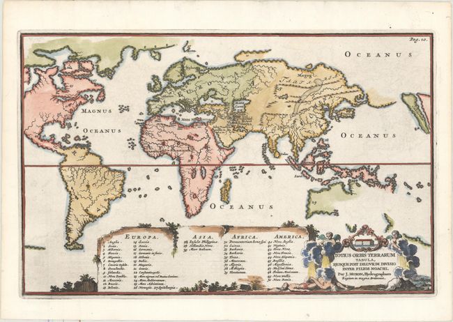
Interesting and unusual world map from an English Bible designed to illustrate how the world was divided among the sons of Noah. The map is presented on Mercator's projection, with Europe, Africa and Asia at the center and South America with a part of North America at left. The island of California is placed at the extreme right of the map, and a Northwest Passage seems entirely probable. This map has practically no detail other than rivers and mountain ranges, except for a tiny engraved depiction of the Garden of Eden located just south of the Caspian Sea. A large table at bottom provides a numeric key to major locations throughout the world. The title cartouche includes a scene of Noah's Ark and the Great Flood. Shirley dates the map 1671 but eludes that the map may possibly be of later date and published by one of the younger members of the family.
References: Shirley #458.
Condition: A
A crisp impression on a clean, bright sheet with very minor offsetting.