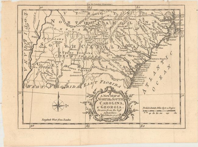
Subject: Colonial Southeast United States
Period: 1765 (published)
Publication: London Magazine
Color: Black & White
Size:
9.1 x 6.8 inches
23.1 x 17.3 cm
A charming small map of the southeast with the boundaries of North Carolina, South Carolina and Georgia extending from the Atlantic coast to the Mississippi River, illustrating the territorial gains the British made during the French & Indian War, which ended in 1763. Numerous Indian tribes are named in the frontier land west of the Appalachians including the Cherokee, Chickasaw, Creek, and Choctaw tribes. The map also depicts towns, Indian villages , forts, watersheds and the topography of the land. Published in the April 1765 issue of London Magazine.
References: Jolly #LOND-244; Cumming #348; Sellers & Van Ee #1390; Phillips (Maps) p. 295, 613 & 819.
Condition: A
A dark impression on a clean sheet with a few tiny chips along the top edge of the sheet far from the map image. Issued folding.