Subject: New England - United States
Period: 1831 (dated)
Publication: A New American Atlas...
Color: Hand Color
Size:
21.6 x 16.9 inches
54.9 x 42.9 cm
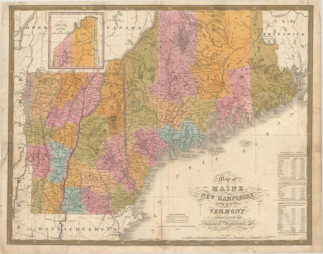
This map comes from Mitchell's first edition A New American Atlas, which utilized the plates used in Finley's 1826 atlas of the same title with an updated publisher's imprint. It depicts counties, roads, proposed and existing canals, and locates scores of towns and villages. At lower right, a "Statistical Table" gives populations by county for 1810 and 1820. Engraved by J.H. Young.
References: Ristow, p. 270.
Condition: B
The map has been severed in half along the centerfold and rejoined using tissue on verso. There are additional professional repairs to a 5.5" edge tear at left and a 2" edge tear at right. Chips in the bottom, left, and top margin have been professionally replaced with a small portion of the border and image at top drawn in facsimile. Light offsetting.