Subject: Eastern United States
Period: 1836 (dated)
Publication:
Color: Hand Color
Size:
14.9 x 12.5 inches
37.8 x 31.8 cm
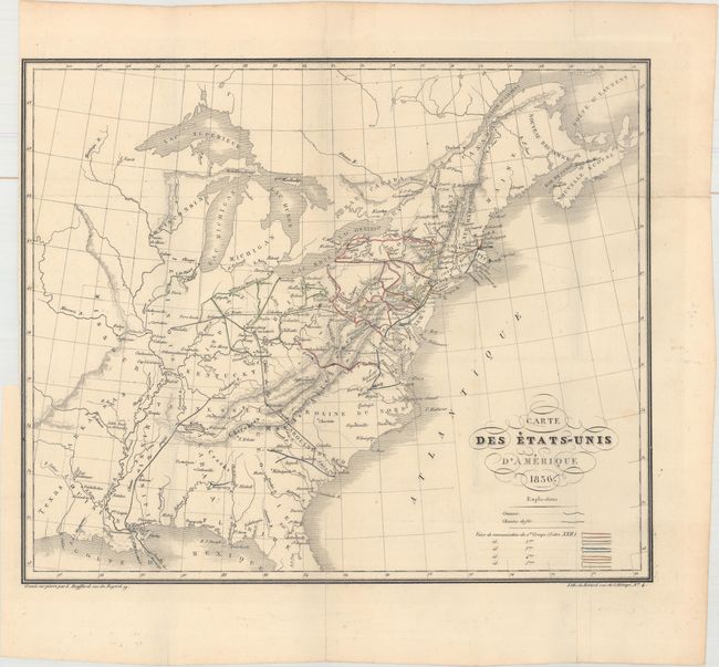
This elegantly engraved French map of the developing United States spans from northern Florida to Nova Scotia and west past the Mississippi River. The most prominent feature of the map is the evolving transportation network, with canals and railroads color-coded into five regional groups. The National Road is depicted from Cumberland to Vandalia, and two projected railroads are shown from New Orleans to Nashville and from Charleston to Cincinnati. Lithographed by Benard and published in Michel Chevalier's Lettres Sur l'Amerique du Nord. Chevalier was commissioned by the French Interior Ministry to study the American transportation network from 1833-35.
References:
Condition: B+
Issued folding on watermarked paper with a few faint spots and a tiny binding tear at left that has been closed on verso with archival material. Binding trim at upper left.