Subject: Eastern United States
Period: 1834 (dated)
Publication:
Color: Black & White
Size:
34.2 x 23.7 inches
86.9 x 60.2 cm
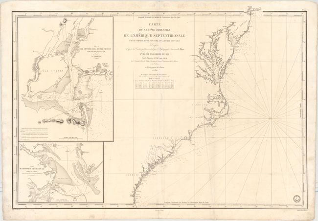
This oversized chart spans from the mouth of the St. Johns River near Jacksonville, Florida, up the Eastern Seaboard to the southern edge of Long Island. It is based on the work of Edmund Blunt. Towns and cities are named, including Savannah, Charleston, Norfolk, Richmond, Washington, D.C., Baltimore, and Philadelphia, but most of the detail is focused on the various waterways meeting the Atlantic. The Chesapeake Bay is rendered in particularly fine detail. There is plenty of navigational information such as soundings and bottom types. Two large insets appear at left: Plan de l'Entree de la Riviere d'Hudson Depuis Sandy Hook Jusqu'a New York and Plan de l'Entree de la Chesapeake. The engraved seal of the Depot de la Marine is at bottom right, with the price Prix. Deux Francs appearing below the neatline. Drawn by J.M. Hacq and engraved by Chassant.
References:
Condition: B+
A nice impression on a watermarked sheet with light soiling and offsetting, an extraneous vertical crease running most of the length of the chart, and a short centerfold separation in the bottom blank margin.