Subject: Eastern United States & Canada
Period: 1832-34 (dated)
Publication:
Color: Black & White
The beginning of the nineteenth century saw a period of rapid market growth and innovation in the map publishing world. Increased literacy and public interest in new frontiers and colonies overwhelmed the market because it was oriented toward the small, affluent market of the previous century. With the intent to fill this void, The Society for the Diffusion of Useful Knowledge (SDUK) was founded in 1828 in London, by Lord Brougham and a group of men dedicated to the education of the aspiring working class and the Utilitarian ideal of 'Knowledge is Power.' The society produced an array of education materials, but the series of maps was one of their most successful ventures. A number of engravers and printers were used to produce the maps, which eventually exceed 200 sheets, and continued to be published after the Society as a whole ceased to function.
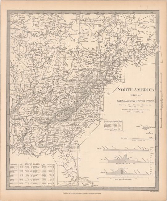
This remarkable, complete set of maps covers the eastern United States and Canada. The first map is the index sheet, which identifies the 14 numbered sheets. The index map includes elevation profiles of the Welland, Rideau, Erie, Pennsylvania, and the Chesapeake and Ohio canals. These important canals formed the transportation network that opened up a connection from the populated Northeast to the Great Lakes and western frontier in the early of the nineteenth century. An extensive table gives population figures for each state and territory from the Census of 1830. Complete, matching set published by Baldwin and Cradock.
A. North America Index Map to Canada and the United States, dated 1834 (12.7 x 14.5").
B. North America Sheet I Nova-Scotia with Part of New Brunswick and Lower Canada, dated 1832 (12.2 x 15.6").
C. North America Sheet II Lower-Canada and New Brunswick with Part of New-York, Vermont and Maine, dated 1832 (15.3 x 13.1").
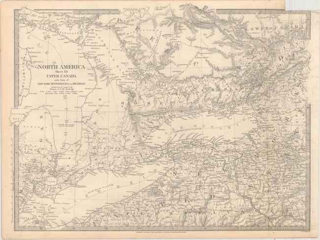
D. North America Sheet III Upper Canada with Parts of New York, Pennsylvania, and Michigan, dated 1832 (17.3 x 12.9").
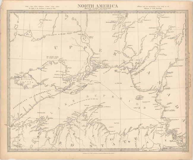
E. North America Sheet IV Lake Superior…, dated 1832 (15.4 x 12.1").
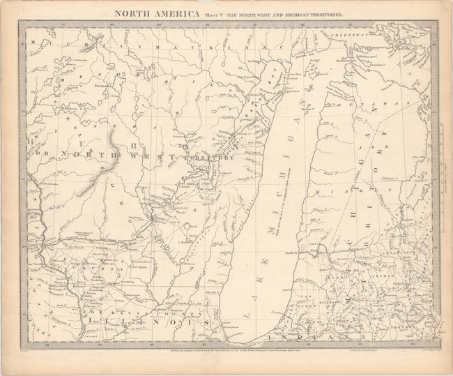
F.North America Sheet V The North West and Michigan Territories, dated 1833 (15.3 x 11.9").
G.North America Sheet VI New-York, Vermont, Maine, New-Hampshire, Massachusetts, Connecticut, Rhode-Island, and New-Jersey, dated 1832 (12.3 x 13.9").
H.North America Sheet VII Pennsylvania, New Jersey, Maryland, Delaware, Columbia and Part of Virginia, dated 1833 (13.0 x 14.8").
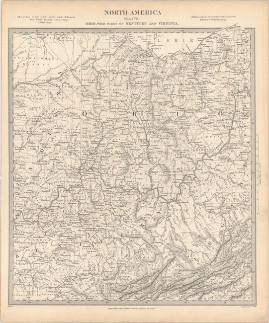
I.North America Sheet VIII Ohio, with Parts of Kentucky and Virginia, dated 1833 (12.4 x 14.1").
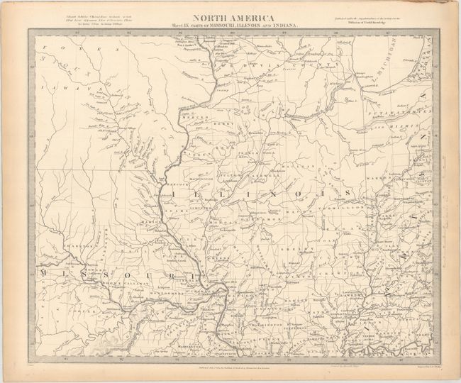
J.North America Sheet IX Parts of Missouri, Illinois and Indiana, dated 1833 (14.4 x 12.1").
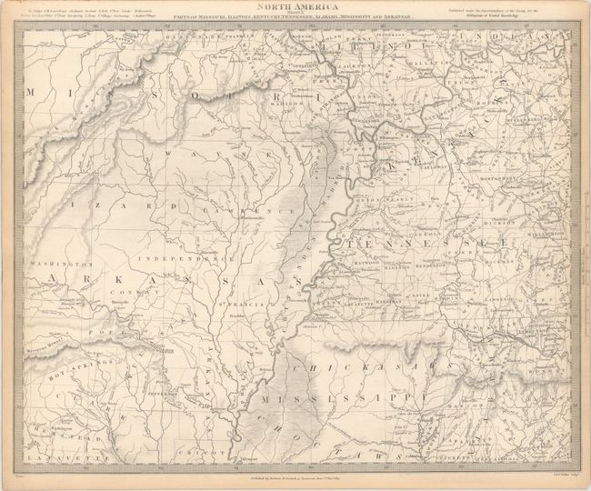
K.North America Sheet X Parts of Missouri, Illinois, Kentucky, Tennessee, Alabama, Mississippi and Arkansas, dated 1833 (15.6 x 12.4").
L.North America Sheet XI Parts of North and South Carolina, dated 1833 (12.9 x 14.9").
M.North America Sheet XII, Georgia with Parts of North & South Carolina, Tennessee, Alabama & Florida, dated 1833 (12.4 x 15.8").
N.North America Sheet XIII Parts of Louisiana, Arkansas, Mississippi, Alabama & Florida, dated 1833 (16.2 x 12.1").
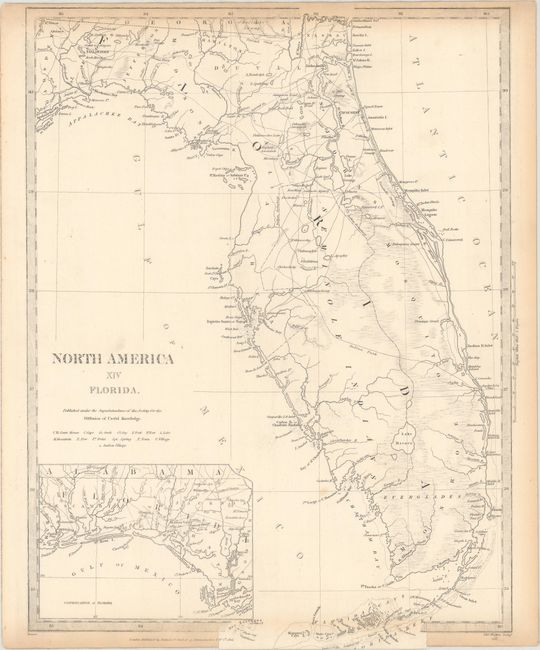
O.North America XIV Florida, dated 1834 (12.1 x 16.3").
References:
Condition: B+
There is minor to light toning on each of the sheets, mostly confined to the edges. Some of the sheets have light spots in the map image. Sheet III has a binding trim at top right with loss of a small portion of the border and a 2" binding tear that has been closed on verso with archival tape. Due to the size of the sheets on which the maps were printed, several maps were printed to the edge of the sheet, missing either a small portion of the neatline or the title outside the map image