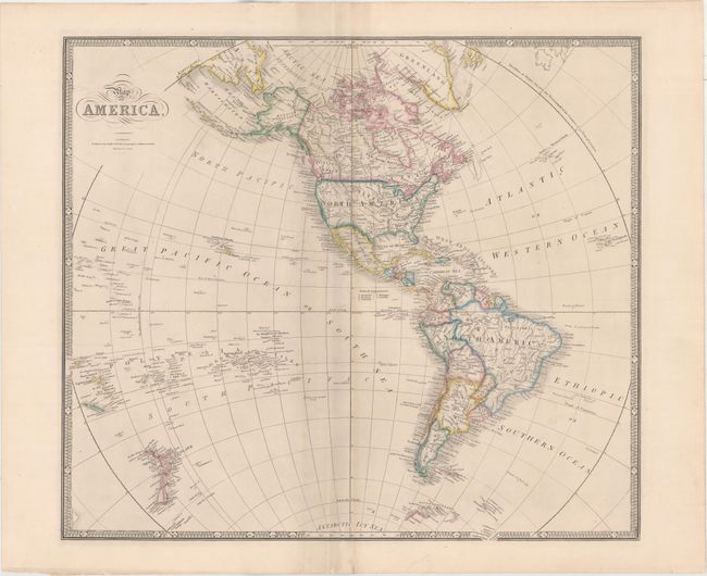
Subject: Western Hemisphere - America
Period: 1855 (circa)
Publication:
Color: Hand Color
Size:
23.4 x 20.4 inches
59.4 x 51.8 cm
This handsome map features nice detail of the hemisphere. In this edition of the map, Texas is part of the United States, and the nation's boundaries are firmly established. Oregon is named twice with one stretching north of the U.S.-Canada border. Freemonts Pass appears in present-day Colorado. The map extends through the Pacific Ocean to include New Zealand and the Pacific Islands where Hawaii is prominently shown. In the Antarctic Icy Sea, and just peeking out of the border are the South Sandwich Islands, labeled Sandwich Land and Southern Thule. Grahams Land is identified in the Antarctic.
References:
Condition: B+
A dark impression with light scattered foxing adjacent to the centerfold. There are short fold separations at top and bottom as well as one edge tear at bottom that are all confined to the blank margins and closed with archival material.