Subject: Exploration & Surveys, Japan, India
Period: 1756 (published)
Publication:
Color: Black & White
Size:
8.4 x 10.5 inches
21.3 x 26.7 cm
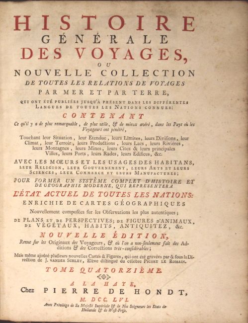
This is a nice example of volume fourteen of Prevost's history of voyages published in 1756, with maps by Jacques Nicolas Bellin & J. Van Schley. The volume is divided into two parts and covers India (193 pp.) and Japan (307 pp.). There are a total of 11 folding maps and plans and 21 folding views and single page plates. The maps, which include additional titles in Dutch, appear in the volume in the following order:
Theatre de la Guerre sur la Cote de Coromandel (9.5 x 12.5").
Plan de Madraz et de Fort St. Georges (12.2 x 7.5").
Carte du District de Tranquebar (12.0 x 11.6").
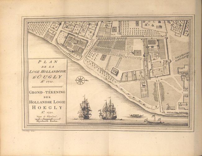
Plan de la Loge Hollandoise d'Ougly (10.7 x 7.1").
Carte de l'Archipel de St. Lazare ou les Isles Marianes (6.1 x 8.7"). Chart of the Mariana Islands includes an inset of Guam with its harbors, rivers, mountains. Fleur-de-lys and rhumb lines make this an attractive little chart.
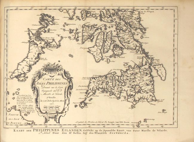
[First Sheet] Carte des Isles Philippines (6.2 x 8.3") and [Second Sheet] Carte des Isles Philippines ... (11.7 x 8.1"). A fine pair of maps covering the Philippines, both with lovely rococo-style title cartouches. The first map depicts the northern islands of the Philippine archipelago, including Luzon and Mindoro. The notable city of Manila is located as well. The map is filled with nice detail throughout. The second is a double page chart which is focused on the southern islands including Mindanao, Palawan, Panay, and part of Borneo.
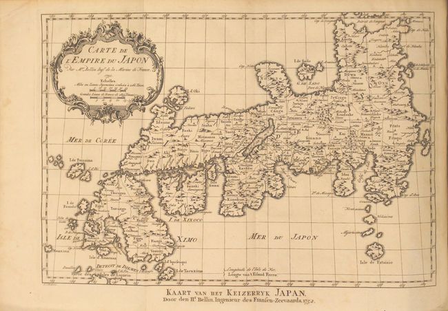
Carte de l'Empire du Japon (12.1 x 8.3"). This is a reduced version of Bellin's influential map made for Jesuit Father Pierre-Francois-Xavier de Charlevoix's Histoire du Japon. Japan is presented basically on the Kaempfer/Scheuchzer model with several corrections to the coastlines, and individual provinces are delineated via engraved line. The Mer de Coree is shown to the west.
Plan de la Ville de Meaco (10.7 x 7.4"). Plan of the city of Kyoto when it was the capital of the country. The block pattern of the city is laid out and is encircled by the Kamo River.
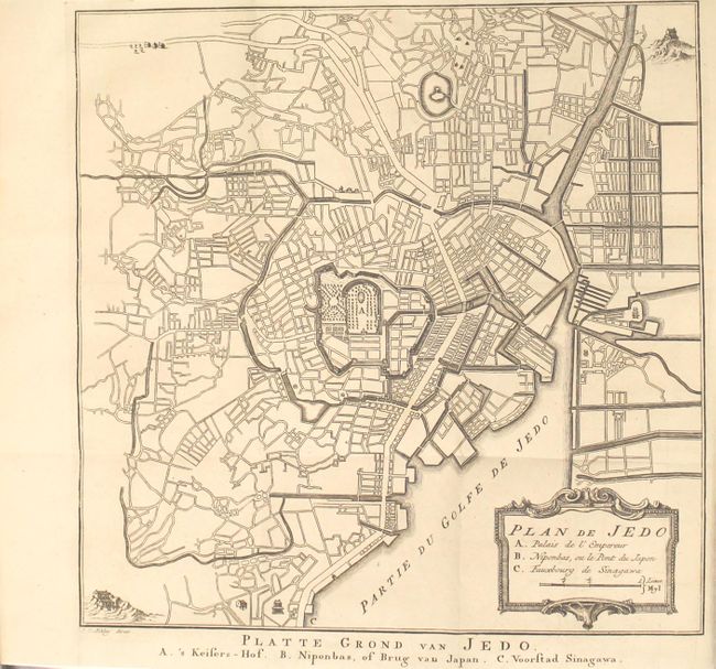
Plan de Jedo (9.7 x 9.7"). This detailed plan of Tokyo is patterned on the Scheuchzer/Kaempfer map of 1702. The grounds surrounding the Edo Palace depict an imaginary, French-style, formal garden. The Nihonbashi (Japan Bridge), marked with a B, is shown east of the palace.
Plan du Port et de la Ville de Nangasaki (13.0 x 7.6"). Bellin's smaller version of this great plan of Nagasaki. The map is oriented to the southwest with a bold compass rose. The map locates the principal points of interest and major buildings. The Desima is central to the map. This artificial island in the bay of Nagasaki was where the VOC (Dutch East India Company) were allowed to trade with the representatives of the Shogun in Edo. Locates a large Temple complex at the end of the bay. The rococo-style title cartouche incorporates the key to locations.
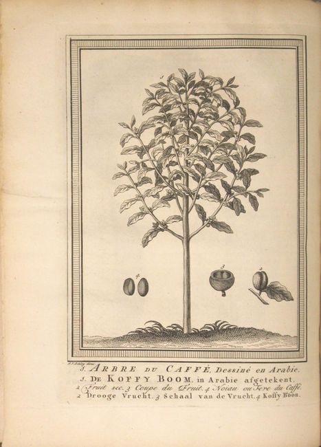
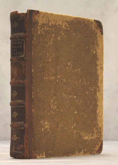
Published by Pierre de Hondt, the book is in quarter leather over marbled boards with gilt tooling and raised bands on spine. Quarto, 500 pages and 32 copper-engraved maps and plates, many folding. Plates feature attractive views of Manilla, Macao, and an interesting single-page plate showing Arabian coffee.
References:
Condition: B+
The maps and plates are very good to near fine with occasional light toning and faint spots of foxing. Text has light toning and scattered foxing. The hinges are starting and the covers are heavily worn. Spine is cracking and chipped at the head.