Subject: Exploration & Surveys, Asia
Period: 1749 (published)
Publication:
Color: Black & White
Size:
7.8 x 10.3 inches
19.8 x 26.2 cm
This is a very nice example of volume seven of Prevost's history of voyages, with maps by Jacques Nicolas Bellin. This volume focuses exclusively on Asia including Korea, China, Mongolia, Tibet, and central Asia. There are a total of 8 maps in the volume and include the following titles:
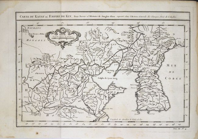
Carte du Katay ou Empire de Kin... (12 x 8"). Attractive map of Korea and Northern China with a good depiction of the Great Wall. The Sea of Japan is marked Mer de Coree. The map was prepared from English sources for a history of Gengis Khan.
Carte de l'Empire de Hya et Partie de Tangut... (12 x 8.5"). This map covers the area along the Silk Road into Tibet and China. The Gobi Desert and Great Wall of China are prominently depicted.
Carte du Grand Thibet... (12 x 8.5").
Carte de Karazm, Turkestan et Grande Bukarie... (12.2 x 8.7"). Centered on Turkestan, the map extends to include the Black and Caspian Seas, Uzbekistan, Tajikistan, Turkmenistan, and the northern reaches of Iran and Afghanistan. Good watershed detail and locates numerous cities and villages.
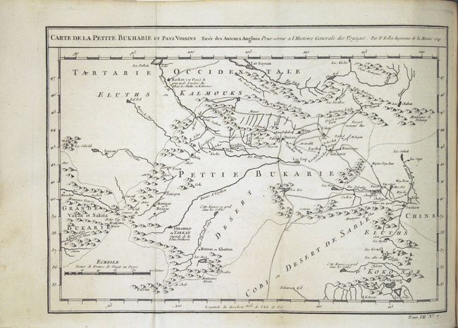
Carte de la Petite Bukharie et Pays Voisins Tiree des Auteurs Anglois... ... (12.3 x 8.6").
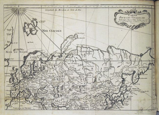
Carte pour les Voyages de Rubruquis, Marco Polo, Jen-kin-son, &c. (13.5 x 9.3"). This attractive engraving shows Europe, Northern Asia and the Arctic Ocean. Marco Polo’s voyage to China is shown along with Jenkinson’s route around Scandinavia to Moscow.
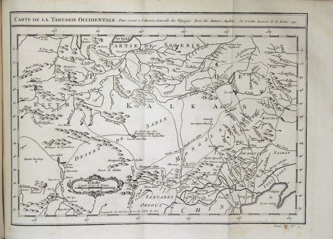
Carte de la Tartarie Occidentale... (12.2 x 8.6"). This map covers western Tartary and focuses on the region of present-day Mongolia. This map reflects information from Kyrkov's important surveys of this remote region in addition to Jesuit and English sources. It includes detail of the roads and shows sections of the Great Wall.
Carte de la Tartarie Orientale... (12.4 x 8.3"). This handsome map covers the eastern part of Tartary with part of present-day Manchuria and Sakhalin Island. The map was based primarily on Jesuit and English sources and is particularly detailed with regard to the river systems.
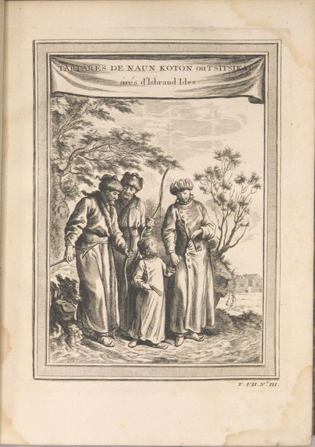
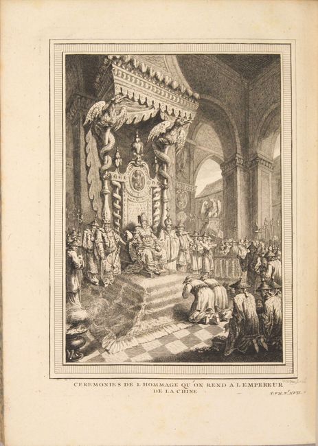
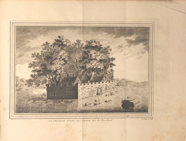
Published by Didot, the book is in full leather with gilt title and raised bands on spine. Quarto, 624 pp., 8 copper-engraved maps and 17 additional plates featuring native costumes, views, and a fascinating depiction of the fall of the Ming Dynasty and the death of the Emperor.
References:
Condition: A
The condition code is for the maps which are overall near fine with faint offsetting and an occasional spot. The text is very good with a small damp stain in the lower right corner of the first 25 pages and occasional light toning or foxing. The title page is damp stained. Covers and spine have light wear and a few abrasions, and the edges are bumped. Former owner's bookplate on inside front cover.