Catalog Archive
Auction 161, Lot 728

"Pascaart van de Zee-Custen van Angola, en Cimbebas van Rivier de Galion tot C. de Bona Esperanca", Doncker, Henrick

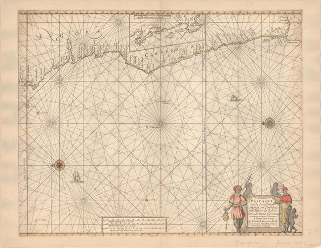
Subject: Western Africa

Period: 1660 (circa)

Publication:

Color: Hand Color

Size:
21.2 x 16.9 inches
53.8 x 42.9 cm
Download High Resolution Image
(or just click on image to launch the Zoom viewer)

This beautifully engraved sea chart covers the western coast of Africa from Gabon south to Cape of Good Hope. An inset placed in the interior of the continent shows the area from St. Martin's Bay to Cape of Good Hope in further detail. The chart locates a number of place names along the coast, as well as several soundings and shoals near Cape of Good Hope. North is oriented to the left by two compass roses capped with fleurs-de-lis. The decorative title cartouche at lower right features natives holding navigational tools.

References:

Condition: B

Trimmed to the neatline all around and entirely backed with old paper to create new margins. There is occasional light toning and a few tiny wormholes along the centerfold.

Estimate: $350 - $425

Sold for: $250

Closed on 2/8/2017

Archived