Subject: Southeast Asia
Period: 1834 (dated)
Publication:
Color: Hand Color
Size:
20.3 x 14.3 inches
51.6 x 36.3 cm
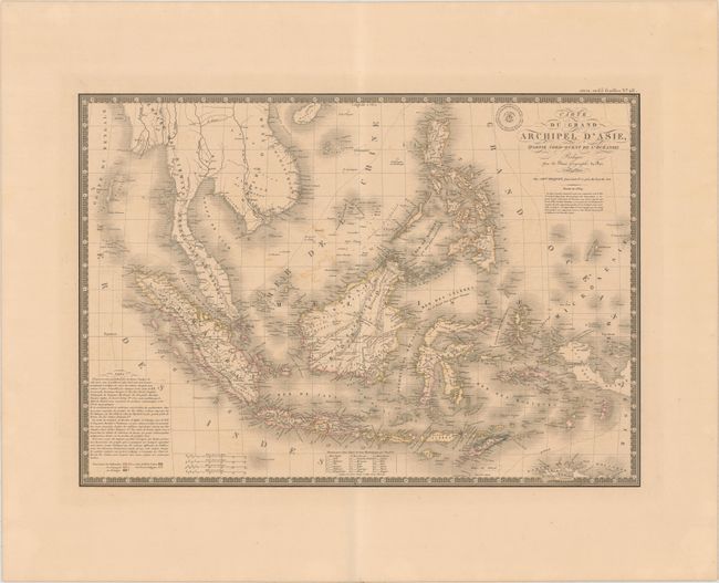
Beautifully engraved and attractive map that shows the entire Indonesian archipelago plus the Philippines, all of the Malay peninsula with part of Indochina. Also delineates the western portion of Papua New Guinea. Superb detail of the many islands including Sumatra, Borneo, Flores, Timor, the Celebes, etc. The nascent settlement of Singapore is named. A color key shows the colonial holdings of Holland, Spain, and Portugal as well as lands held by indigenous royals. By the time this map was published the British had abandoned their holdings in Sumatra and Java under the 1824 Anglo-Dutch Treaty, in exchange for control of their possessions in the Malay Peninsula and Dutch India. This is the updated 1834 map from the 1826 edition. Surrounded by a decorative keyboard-style border with an original embossed stamp from Charles Picquet, publisher and successor to Brue, to the left of the title.
References:
Condition: B+
Light toning with just a bit of offsetting along the centerfold.