Subject: Southeast Asia
Period: 1828 (circa)
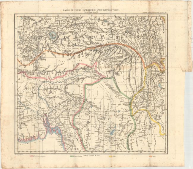
Publication: Nouvelles Annales des Voyages et des Sciences Geographiques
Color: Hand Color
Size:
16.9 x 15.6 inches
42.9 x 39.6 cm
This map was published in the seventh volume of Klaproth's Nouvelles Annales des Voyages et des Sciences Geographiques. It covers the region from Islamabad north to Krygyzstan and east to Tibet, China and Burma. The map depicts the rugged terrain of the region and the numerous river systems winding through the mountains in good detail. A color-coded key at bottom identifies the possessions of England, Burma, China and Tibet. A detailed and uncommon map by the traveler and orientalist Julius Heinrich von Klaproth.
References:
Condition: B
On watermarked paper with light scattered foxing that is more prominent in the blank margins and fold lines. Issued folding with a binding tear confined to the right blank margin.