Catalog Archive
Auction 161, Lot 678

"[Lot of 2] Carte des Parties Nord, et Est de l'Asie qui Comprend les Cotes de la Russie Asiatique... [and] Nouvelle Representation des Cotes Nord et Est de l'Asie...", Robert de Vaugondy/Diderot

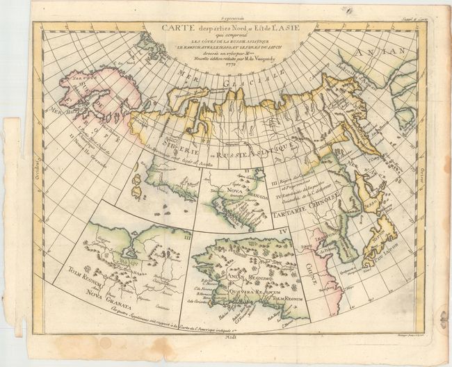
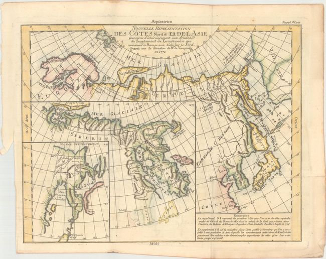
Subject: Northern Asia & Western North America

Period: 1772 (dated)

Publication: Diderot's Encyclopedia (Supplement)

Color: Hand Color

Size:
14.7 x 11.8 inches
37.3 x 30 cm
Download High Resolution Image
(or just click on image to launch the Zoom viewer)

The Encyclopedie was published under the direction of Diderot from 1751 onward with thousands of articles written by the most prominent philosophers and scientists of the time. These great minds collaborated in the goal of assembling and disseminating the fruits of accumulated knowledge and learning. This massive reference work for the arts and sciences, served to propagate Enlightened ideas. Read a full description of this work and Diderot at Wikipedia.com.

This intriguing pair of maps offers an informative overview of some of the early cartographic theories concerning the northern part of Asia and the western part of North America, as well as the Arctic search for a Northwest Passage.

A. Carte des Parties Nord, et Est de l'Asie qui Comprend les Cotes de la Russie Asiatique.... This unusual map details the northern coastline of Russia (including Scandinavia), the eastern coast of Asia to below Nanking, and a bit of the coast of America called Anian. Inset into the map are four small maps of the western part of North America: I - Features the entire western coast with Japan just a short distance offshore; II - Focuses on Nova Granada showing the Mexican coast of the Gulf of California; III - Focuses on the Zubgara and Tolm Regnum of Nova Granada and the mythical seven cities of Cibola; and IV - Depicts Anian Regnum including Quivira Regnum and another Tolm Regnum. All together a fascinating view of some of the early cartographic theories concerning the western part of North America. This is a re-engraved edition by Heidegger.

B. Nouvelle Representation des Cotes Nord et Est de l'Asie.... Interesting map of the northeast coast of Asia depicting Kamchatka, Japan and Korea. It also shows part of what is present-day Alaska. The Tchutski (Chukotskiy) Peninsula stretches very close to the American landmass, hinting at a possible land bridge. Within the larger map are two insets (one within the other). The insets represent an evolving understanding of the geography of Kamachatka, with the map being the latest iteration. The first inset, No. 1, was completed by Abu al-Ghazi Bahadur, who was the ruler of Khiva in present-day Uzbekistan for 20 years.

References: Pedley #402 & #406; Wagner (NW) #637, pp. 158-162.

Condition: B+

Issued folding, now pressed, with light offsetting. There are several minor damp stains confined to the blank margins.

Estimate: $240 - $300

Unsold

Closed on 2/8/2017

Archived