Subject: Holy Land
Period: 1650 (published)
Publication: A Pisgah-Sight of Palestine
Color: Hand Color
Size:
13.3 x 11.1 inches
33.8 x 28.2 cm
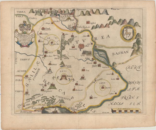
This delightfully illustrated map covers the territory of Napthali, one of the twelve tribes of Israel. Bounded by the Lebanon Mountains in the north to the Sea of Galilee, the map is roughly centered on Kadesh, its most prominent town and the Jordan River is prominently depicted. The map is filled with pictorial illustrations and is embellished with a coat of arms and dedication to Thomas Bowyer and the shield of the Tribe of Napthali. Engraved by Thomas Cross.
Thomas Fuller (1608-1661) was a respected English clergyman who wrote several books on the history and geography of the Holy Land. His A Pisgah-Sight of Palestine, published in 1650, was a geographical description of the Holy Land with special reference to biblical history. Fuller financed the book by dividing it into sections and finding sponsors for each one. To acknowledge the patrons, all maps contained decorative cartouches with the sponsor's coat of arms and a dedication to him.
References: Laor #283; Nebenzahl (HL) p.128-131, #6; Shirley (BL Atlases) G.FULL-1a #5.
Condition: A
A dark impression with light printer's ink residue on paper with a small coat of arms watermark. There is light toning along the edges of the sheet.