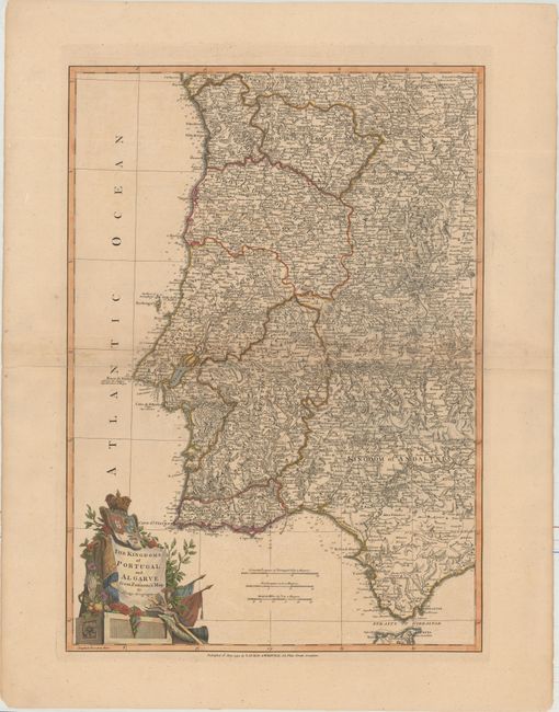
Subject: Portugal & Western Spain
Period: 1794 (dated)
Publication: A New Universal Atlas
Color: Hand Color
Size:
16.3 x 22.9 inches
41.4 x 58.2 cm
An uncommon and well engraved chart that details the coast from Marbella, through Gibraltar and up the Portuguese coast to Bayona, Spain. Excellent details with scores of villages and towns, roads, plus much topographical information. The large, decorative cartouche features the coat-of-arms, flags, flowers and Christ on the crucifix. Engraved by John Lodge and based on a two-sheet map by Giovanni Antonio Rizzi-Zannoni, Mapa dos Reynos de Portugal e Algarve….
References: Shirley (BL Atlases) T.LAU-1a #20.
Condition: B
Original outline color with later color in the cartouche, light toning along the centerfold, and faint offsetting. The map was completely separated along the centerfold and has been reattached with archival tape. A few small cracks have been backed with archival material.