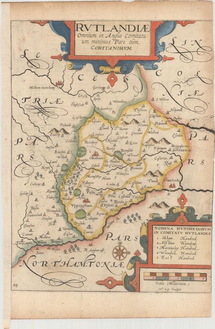
Subject: Central England
Period: 1637 (published)
Publication: Camden's Britannia
Color: Hand Color
Size:
8.4 x 11.3 inches
21.3 x 28.7 cm
An early map of the county of Rutland engraved by William Kip and based upon the famous survey by Christopher Saxton. It is fully engraved to illustrate all the salient features of the county including market towns, forests, parks, hills and bridges. Decorated with large strapwork title and scale cartouches. Published in the 1637 edition of Camden's Britannia, with the addition of a plate number on the map.
References: Shirley (BL Atlases) T.CAMD-1e.
Condition: B
A crisp impression on paper with a large coat of arms watermark, light printer's ink residue and minor soiling. Trimmed to the neatline at right by the book binder, with partial loss of neatline. This map is typically found with little to no side margins due to the way it was bound into the book.