Subject: Iceland
Period: 1860 (circa)
Publication: The Royal Illustrated Atlas, Of Modern Geography
Color: Hand Color
Size:
12.4 x 18 inches
31.5 x 45.7 cm
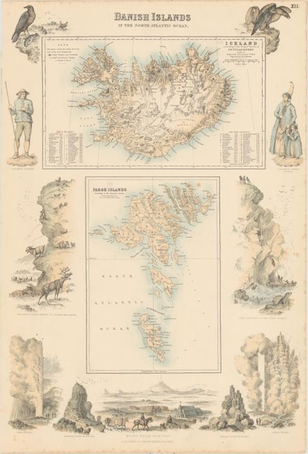
This sheet features two maps, the first showing Iceland and the second the Faroe Islands. The map of Iceland, drawn by Augustus Petermann and engraved by G.H. Swanston, depicts mountains, glaciers, snowfields, fjords, and hot and mineral springs. The elevations of the mountains (in feet) can be found in a list within the neatline. The Faroe Islands map, engraved by Swanston, similarly captures the topography of the land and shows many fjords and towns. Surrounding the plates are a series of fascinating vignettes showing figures in tradition Icelandic garb, Mount Hecla, geysers, reindeer, a seal, and other regional wildlife.
References:
Condition: B+
There are a few spots of foxing mostly along the sheet edges.