Subject: North Atlantic
Period: 1831 (dated)
Publication: The American Coast Pilot
Color: Black & White
Size:
12.4 x 7.4 inches
31.5 x 18.8 cm
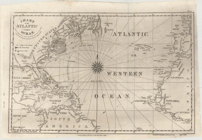
This uncommon chart of the Atlantic Ocean stretches from eastern North America, the Caribbean, and the northern tip of South America to Portugal, Spain, and a portion of Africa. The Gulf Stream is featured, and a key explains the different types of arrows used to depict varying winds and currents. A few notes chronicle the hurricane season of 1830 by pointing out the date and location of the storms. A compass rose with a fleur-de-lis radiates rhumb lines in the chart's center. Engraved by William Hooker.
Edmund March Blunt (1770-1862) founded the company circa 1796 and published the first edition of Captain Lawrence Furlong's American Coast Pilot in 1796. The earliest editions of Blunt's work did not contain any charts and focused instead on verbal descriptions of sailing directions, tide tables, latitudes and longitudes, and navigational landmarks. In later editions, Blunt included charts of harbors and sections of the coast, some produced by others as well as those of his sons, Edmund and George William. After Blunt's retirement, his sons continued to issue sea charts, considered some of the best American charts of the time due to their use of the latest U.S. Coast Surveys. In 1867 the Blunts sold the rights to the American Coast Pilot to the U.S. Coast Survey.
References:
Condition: B+
Issued folding with a few faint spots of foxing and minor extraneous creasing adjacent to the left fold. There is light printer's ink residue which is more prominent in the upper half of the image.